Difference between revisions of "2021-03-24 42 -82"
(→Photos: add some photos to gallery) |
(→Expedition: Ames, not Ames Road. I reviewed dashcam footage) |
||
| (5 intermediate revisions by 2 users not shown) | |||
| Line 29: | Line 29: | ||
It was pretty easy to spot the car ferry due to the short queue of cars that had built up in the turning lane, and I reached it at 17:52. It was interesting to discover that my car's factory satnav knew about the ferry route. | It was pretty easy to spot the car ferry due to the short queue of cars that had built up in the turning lane, and I reached it at 17:52. It was interesting to discover that my car's factory satnav knew about the ferry route. | ||
| − | Driving off the ferry and onto the island, I got slightly lost and had to drive around aimlessly a bit until I found a place to turn off and check maps on my phone. I didn't think to do it in the ferry parking lot, and most roads on the island are too narrow and bordered too closely by marshland to pull off on the shoulder. Once I did that, I was able to find the parking area I planned to park in. A sign identified it as the '''Ames | + | Driving off the ferry and onto the island, I got slightly lost and had to drive around aimlessly a bit until I found a place to turn off and check maps on my phone. I didn't think to do it in the ferry parking lot, and most roads on the island are too narrow and bordered too closely by marshland to pull off on the shoulder. Once I did that, I was able to find the parking area I planned to park in. A sign identified it as the '''Ames Boat Access Site'''. I parked up, got out of my car at 18:13, and perused the various signs posted at the boat ramp and at the gate to the berms to the hashpoint. Signs posted next to the gate read '''Authorized Vehicles Only''', '''Hunting/Entry by Permit Only Sept. 1 -- Jan. 1''', and '''No Motorized Vehicles'''. I was confident that that meant pedestrian access to the berms on 24 March was unrestricted, so I continued to the hashpoint. |
After a brief walk with the sounds of various wild birds, I reached the hashpoint at 18:31. (Well, within 5m of the hashpoint, as the point itself lay just on the other bank of a canal. I'm still calling this "coordinates reached", though, because I got within 0.001 degrees.) Then I walked back to my car and began the drive off the island. | After a brief walk with the sounds of various wild birds, I reached the hashpoint at 18:31. (Well, within 5m of the hashpoint, as the point itself lay just on the other bank of a canal. I'm still calling this "coordinates reached", though, because I got within 0.001 degrees.) Then I walked back to my car and began the drive off the island. | ||
| Line 40: | Line 40: | ||
== Tracklog == | == Tracklog == | ||
| − | + | [[:File:2021-03-24 42 -82.gpx]] | |
== Photos == | == Photos == | ||
<gallery perrow="5"> | <gallery perrow="5"> | ||
| + | File:2021-03-24 42 -82 walking route.png | The walking route I planned to take. | ||
File:2021-03-24 42 -82 traffic backup.jpg | The traffic backup on the I-696 to I-94 ramp. | File:2021-03-24 42 -82 traffic backup.jpg | The traffic backup on the I-696 to I-94 ramp. | ||
File:2021-03-24 42 -82 BWAT bus.jpg | A Blue Water Area Transit bus, doing the M-29 express route. | File:2021-03-24 42 -82 BWAT bus.jpg | A Blue Water Area Transit bus, doing the M-29 express route. | ||
| Line 56: | Line 57: | ||
File:2021-03-24 42 -82 car in parking lot.jpg | My car in the parking lot of the boat access site. | File:2021-03-24 42 -82 car in parking lot.jpg | My car in the parking lot of the boat access site. | ||
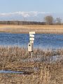
File:2021-03-24 42 -82 posted.jpg | Signs posted at the gate to the berm paths through the marsh. | File:2021-03-24 42 -82 posted.jpg | Signs posted at the gate to the berm paths through the marsh. | ||
| + | File:2021-03-24 42 -82 grasslands are great.jpg | Grasslands are great! | ||
| + | File:2021-03-24 42 -82 berm paths through marsh.jpg | Raised berm footpaths through the marsh. | ||
| + | File:2021-03-24 42 -82 more berm path.jpg | More path. | ||
| + | File:2021-03-24 42 -82 even more berm path.jpg | Even more path. | ||
| + | File:2021-03-24 42 -82 grassy bit.jpg | A grassy bit in a path. | ||
| + | File:2021-03-24 42 -82 burrow 1.jpg | A burrow likely belonging to some sort of wild animal. | ||
| + | File:2021-03-24 42 -82 burrow 2.jpg | Another burrow. | ||
| + | File:2021-03-24 42 -82 bat house maybe.jpg | I think this might be a bat house, maybe? | ||
| + | File:2021-03-24 42 -82 another bat house maybe.jpg | Maybe another bat house? | ||
| + | File:2021-03-24 42 -82 hashpoint.jpg | A picture of the hashpoint across the canal. | ||
| + | File:2021-03-24 42 -82 hashpoint selfie.jpg | Selfie at the hashpoint! | ||
| + | File:2021-03-24 42 -82 hashproof.jpeg | Proof I reached the hashpoint! | ||
| + | File:2021-03-24 42 -82 still an hour before sunset.jpg | By this time, it was still an hour before sunset. | ||
| + | File:2021-03-24 42 -82 earth mover tracks.jpg | Tracks from some earth-moving equipment used to maintain the paths. | ||
| + | File:2021-03-24 42 -82 public hunting area.jpg | Public hunting area sign. | ||
| + | File:2021-03-24 42 -82 public hunting area 2.jpg | Another public hunting area sign. | ||
| + | File:2021-03-24 42 -82 public hunting area far.jpg | Public hunting area sign from further out. | ||
| + | File:2021-03-24 42 -82 idk what this thing is.jpg | I've no idea what this thing is. | ||
| + | File:2021-03-24 42 -82 harsens island distillery.jpg | Harsens Island Distillery, in the small commercial strip. | ||
| + | File:2021-03-24 42 -82 readers cove and island grind.jpg | Readers Cove library and Island Grind café. | ||
| + | File:2021-03-24 42 -82 sans souci bar.jpg | Sans Souci Bar for sale. | ||
| + | File:2021-03-24 42 -82 harsens island historical society.jpg | Harsens Island Historical Society sign. | ||
| + | File:2021-03-24 42 -82 st pauls.jpg | St. Paul's, a church on the island. | ||
| + | File:2021-03-24 42 -82 mdot park and ride.jpg | A state-sponsored carpool parking lot near the ferry terminal. | ||
| + | File:2021-03-24 42 -82 no step on snek.jpg | The ferry terminal was flying a Gadsden flag on the Algonac side. Ugh. | ||
| + | File:2021-03-24 42 -82 marine city vgs.jpg | VG's, a grocery store in Marine City. I grew up going to a VG's in Flint which no longer exists. | ||
| + | File:2021-03-24 42 -82 cod sando.jpg | My cod sandwich! | ||
| + | File:2021-03-24 42 -82 whole tracklog.png | The whole tracklog. | ||
</gallery> | </gallery> | ||
| Line 61: | Line 90: | ||
{{#vardefine:ribbonwidth|800px}} | {{#vardefine:ribbonwidth|800px}} | ||
<!-- Add any achievement ribbons you earned below, or remove this section --> | <!-- Add any achievement ribbons you earned below, or remove this section --> | ||
| + | {{Minesweeper geohash | ||
| + | | graticule = Detroit, Michigan | ||
| + | | ranknumber = 2 | ||
| + | | e = true | ||
| + | | nw = true | ||
| + | | name = Alison | ||
| + | }} | ||
| + | {{OpenStreetMap achievement | ||
| + | | latitude = 42 | ||
| + | | longitude = -82 | ||
| + | | date = 2021-03-24 | ||
| + | | OSMlink = 102087298 | ||
| + | | name = [[User:Alison|Alison]] | ||
| + | | image = 2021-03-24 42 -82 car in parking lot.jpg | ||
| + | }} | ||
| − | |||
| − | |||
| − | |||
| − | |||
| − | |||
| − | |||
| − | |||
| − | |||
| − | |||
| − | |||
| − | |||
| − | |||
| − | |||
| − | |||
[[Category:Expeditions]] | [[Category:Expeditions]] | ||
| − | |||
[[Category:Expeditions with photos]] | [[Category:Expeditions with photos]] | ||
| − | |||
| − | |||
| − | |||
| − | |||
| − | |||
[[Category:Coordinates reached]] | [[Category:Coordinates reached]] | ||
| − | + | {{location|US|MI|SA}} | |
| − | |||
| − | |||
| − | |||
| − | |||
| − | |||
| − | |||
| − | |||
| − | |||
| − | |||
| − | |||
| − | |||
| − | |||
| − | |||
| − | |||
| − | |||
| − | |||
| − | |||
Latest revision as of 03:47, 1 April 2021
| Wed 24 Mar 2021 in 42,-82: 42.5911091, -82.5929936 geohashing.info google osm bing/os kml crox |
Location
In a marsh in Harsens Island, Michigan. Harsens Island is a rural, marshy island in Lake St Clair off the coast of Algonac, accessible only by boat and car ferry. While there are some houses and businesses on the island, most land there is owned by the Michigan Department of Natural Resources and it's a popular spot for hunting and fishing.
Participants
Plans
MusicalMitten pointed out on Wednesday morning that the day's hash in the Windsor graticule was on Harsens Island. He, Nixill, and I briefly discussed plans for a group trip out to the island, but ultimately I was the only one who had time for the trip. (It's at least a 2.5 hour round trip from any of our houses by car, impractical by bike, and impossible by public transit.) I planned on leaving home around 16:30 to arrive at the island about 18:00, visit the hash before sunset (19:45ish) and have dinner on the island, then leave the island and drive home. The car ferry runs every fifteen minutes from 04:30 to midnight, so I was reasonably confident I wasn't going to get stranded on the island.
As for planning my route to the hashpoint, I relied on satellite imagery because there is no Google Street View on the island and I had never visited before. Raised berms make a network of pathways through the island's marshy interior, and I found what looked like a parking area about 1.2 km north of the hashpoint. I planned on parking at the parking area and walking the rest of the way.
Expedition
I left my house about 16:55 to drive to the entrance of the car ferry. The drive went pretty smoothly except for traffic that quickly backed up near the I-696 exit to eastbound I-94. I've gotten into crashes in sudden traffic jams before, so that had me on edge until I got onto M-29 in New Baltimore around 17:37. Driving up M-29, I saw a lot of Trump flags and one trans flag in front of houses, a Blue Water Transit M-29 bus, and the Bouvier Bridge, a pretty neat pedestrian bridge that links a marina and RV resort across M-29.
It was pretty easy to spot the car ferry due to the short queue of cars that had built up in the turning lane, and I reached it at 17:52. It was interesting to discover that my car's factory satnav knew about the ferry route.
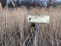
Driving off the ferry and onto the island, I got slightly lost and had to drive around aimlessly a bit until I found a place to turn off and check maps on my phone. I didn't think to do it in the ferry parking lot, and most roads on the island are too narrow and bordered too closely by marshland to pull off on the shoulder. Once I did that, I was able to find the parking area I planned to park in. A sign identified it as the Ames Boat Access Site. I parked up, got out of my car at 18:13, and perused the various signs posted at the boat ramp and at the gate to the berms to the hashpoint. Signs posted next to the gate read Authorized Vehicles Only, Hunting/Entry by Permit Only Sept. 1 -- Jan. 1, and No Motorized Vehicles. I was confident that that meant pedestrian access to the berms on 24 March was unrestricted, so I continued to the hashpoint.
After a brief walk with the sounds of various wild birds, I reached the hashpoint at 18:31. (Well, within 5m of the hashpoint, as the point itself lay just on the other bank of a canal. I'm still calling this "coordinates reached", though, because I got within 0.001 degrees.) Then I walked back to my car and began the drive off the island.
I had originally planned to get dinner and eat outside on the island, but I pulled into a small commercial strip just as the konbini was closing, and both restaurants were closed and for sale. Covid must have really hurt Harsens Island businesses. With no dinner options on the island (at least that I knew of; checking Google Maps after the fact I see that Brown's Bar was open on the other end of the island), I decided it was time to take the ferry back to the mainland and get dinner there.
I parked up in a strip mall in Algonac (slightly east of the ferry docks) to consider my dinner options and eventually settled on the Marine City Fish Company about nine miles (14 km) north along the coast. I ordered a cod sandwich and a Bing cherry pie and headed up there. The soundtrack for this part of the trip was CFRZ 98.3, the radio station of the nearby Walpole Island First Nation. My friend who had done US Census outreach work on Harsens Island last year recommended it to me.
After I finished eating my dinner (in a covid-safe manner in my car) I planned my trip back home. I tuned into CFRZ's web stream and took Marine City Highway west to I-94, then I-94 to I-696, and I-696 to home.
Tracklog
Photos
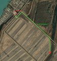
The walking route I planned to take.
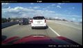
The traffic backup on the I-696 to I-94 ramp.
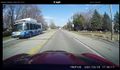
A Blue Water Area Transit bus, doing the M-29 express route.
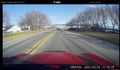
The Bouvier Bridge.
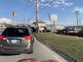
Cars queueing up to board the ferry to Harsens Island.
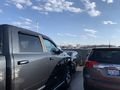
On the ferry!
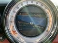
My car's satnav knows about the ferry.
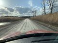
A typical narrow dirt road on Harsens Island with marsh on either side.
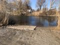
The boat ramp at the Ames Road Boat Access Site.
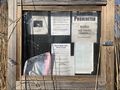
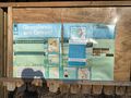
Noticeboard posted at the boat ramp.
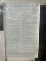
Rules for state-owned land.
My car in the parking lot of the boat access site.
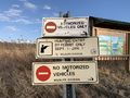
Signs posted at the gate to the berm paths through the marsh.
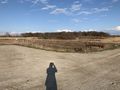
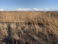
Grasslands are great!
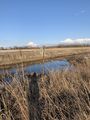
Raised berm footpaths through the marsh.
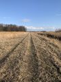
More path.
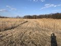
Even more path.
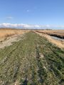
A grassy bit in a path.
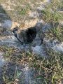
A burrow likely belonging to some sort of wild animal.
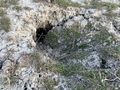
Another burrow.
I think this might be a bat house, maybe?
Maybe another bat house?
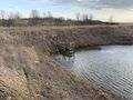
A picture of the hashpoint across the canal.

Selfie at the hashpoint!

Proof I reached the hashpoint!
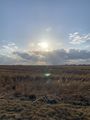
By this time, it was still an hour before sunset.
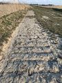
Tracks from some earth-moving equipment used to maintain the paths.
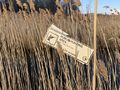
Public hunting area sign.
Another public hunting area sign.
Public hunting area sign from further out.
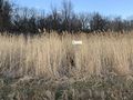
I've no idea what this thing is.
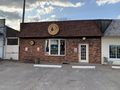
Harsens Island Distillery, in the small commercial strip.
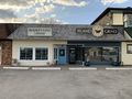
Readers Cove library and Island Grind café.
Sans Souci Bar for sale.
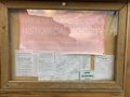
Harsens Island Historical Society sign.
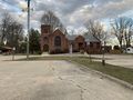
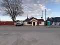
St. Paul's, a church on the island.
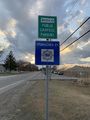
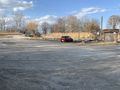
A state-sponsored carpool parking lot near the ferry terminal.
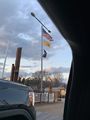
The ferry terminal was flying a Gadsden flag on the Algonac side. Ugh.

VG's, a grocery store in Marine City. I grew up going to a VG's in Flint which no longer exists.
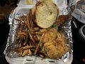
My cod sandwich!
The whole tracklog.


Achievements
Alison achieved level 2 of the Minesweeper Geohash achievement
|
Alison earned the OpenStreetMap achievement
|