Difference between revisions of "2021-07-11 -37 144"
From Geohashing
Felix Dance (talk | contribs) (Added expedition template) |
Felix Dance (talk | contribs) (Added photos) |
||
| Line 1: | Line 1: | ||
| − | [[Image:{{{image|}}}|thumb|left]] | + | [[Image:{{{image|Geohash 2021-07-11 -37 144 06 Hash.jpg}}}|thumb|left]] |
{{meetup graticule | {{meetup graticule | ||
| Line 16: | Line 16: | ||
*Ruth | *Ruth | ||
| − | == | + | == Expedition == |
== Photos == | == Photos == | ||
| − | + | <gallery> | |
| − | + | File:Geohash 2021-07-11 -37 144 01 Path.jpg|Debris-strewn track to the hash | |
| − | + | File:Geohash 2021-07-11 -37 144 02 Crek.jpg|Creek near the hash | |
| − | + | File:Geohash 2021-07-11 -37 144 03 Dam.jpg|Small dam | |
| + | File:Geohash 2021-07-11 -37 144 04 Hill.jpg|Hash hill | ||
| + | File:Geohash 2021-07-11 -37 144 05 GPS.jpg|GPS Proof | ||
| + | File:Geohash 2021-07-11 -37 144 06 Hash.jpg|At the hash! | ||
| + | File:Geohash 2021-07-11 -37 144 07 Forest.jpg|Hash-forest | ||
| + | File:Geohash 2021-07-11 -37 144 08 Tree.jpg|Fallen tree | ||
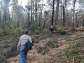
| + | File:Geohash 2021-07-11 -37 144 09 Steve.jpg|Steve creek-crossing | ||
| + | </gallery> | ||
[[Category:Expeditions]] | [[Category:Expeditions]] | ||
Revision as of 07:27, 11 July 2021

| Sun 11 Jul 2021 in -37,144: -37.4553794, 144.3086307 geohashing.info google osm bing/os kml crox |
Location
In Lerderderg State Park west of Melbourne.
Participants
- Felix Dance
- Stevage
- Ruth
Expedition
Photos
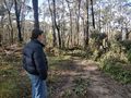
Debris-strewn track to the hash
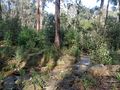
Creek near the hash
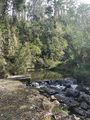
Small dam
Hash hill

GPS Proof
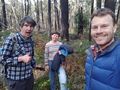
At the hash!
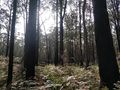
Hash-forest
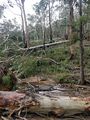
Fallen tree
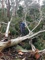
Steve creek-crossing


