2021-09-04 60 25
From Geohashing
| Sat 4 Sep 2021 in Vantaa: 60.3326847, 25.1209803 geohashing.info google osm bing/os kml crox |
Location
Farmland near the Keravanjoki in Sipoo
Participants
Plans
Leave Rautatientori on the 739 at 14:44; get off at Myyras then walk to the geohash. Will wait until after 4, then return to Myyras head towards Bierhaus Köln for a pint.
Expedition
Tracklog
Photos
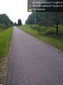
Walk/bicycle trail @60.3328,25.1245
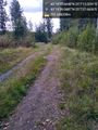
Trail leading down to the field @60.3331,25.1244
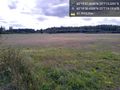
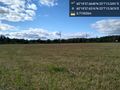
The field @60.3329,25.1220

Geohasher - outstanding in the field @60.3327,25.1210
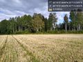
Looking back towards road @60.3327,25.1210
To the west, a highway @60.3327,25.1210


