Difference between revisions of "2022-04-15 -36 146"
From Geohashing
| Line 1: | Line 1: | ||
| − | + | [[File:1f114ed0-d58e-4737-aa76-027906523fc4.jpg|400px|thumb|left]] | |
| − | + | {{meetup graticule | |
| − | |||
| − | |||
| − | |||
| − | |||
| − | |||
| − | |||
| − | |||
| lat={{#explode:{{SUBPAGENAME}}| |1}} | | lat={{#explode:{{SUBPAGENAME}}| |1}} | ||
| lon={{#explode:{{SUBPAGENAME}}| |2}} | | lon={{#explode:{{SUBPAGENAME}}| |2}} | ||
Revision as of 01:28, 15 April 2022
| Fri 15 Apr 2022 in -36,146: -36.5309590, 146.3588973 geohashing.info google osm bing/os kml crox |
Location
In a paddock not far off the Wangaratta-Whitfield Road.
Participants
Plans
Felix's plan was to ignore this geohash, as he attempted a 130km bike ride from Wangaratta to a lodge on top of Mt Hotham.
Expedition
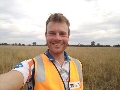
Something went wrong. It's unclear how the plan failed exactly, but somehow Felix ended up right at the hash at 11:12am local time.
