Difference between revisions of "2022-05-26 47 -122"
From Geohashing
([live picture]Geohasher [https://openstreetmap.org/?mlat=47.67281300&mlon=-122.37881890&zoom=16 @47.6728,-122.3788]) |
([live picture]Ballard Corners park [https://openstreetmap.org/?mlat=47.67461200&mlon=-122.37917097&zoom=16 @47.6746,-122.3792]) |
||
| Line 32: | Line 32: | ||
Image:2022-05-26_47_-122_thomcat_1653596112125.jpg|Geohasher [https://openstreetmap.org/?mlat=47.67281300&mlon=-122.37881890&zoom=16 @47.6728,-122.3788] | Image:2022-05-26_47_-122_thomcat_1653596112125.jpg|Geohasher [https://openstreetmap.org/?mlat=47.67281300&mlon=-122.37881890&zoom=16 @47.6728,-122.3788] | ||
| + | |||
| + | Image:2022-05-26_47_-122_thomcat_1653596389450.jpg|Ballard Corners park [https://openstreetmap.org/?mlat=47.67461200&mlon=-122.37917097&zoom=16 @47.6746,-122.3792] | ||
</gallery> | </gallery> | ||
Revision as of 20:19, 26 May 2022
| Thu 26 May 2022 in Seattle: 47.6728304, -122.3787997 geohashing.info google osm bing/os kml crox |
Location
On 17th ave (a temporary walking only street) in central Ballard.
Participants
Plans
Walking the dog down that street between 1:00 and 1:30
- Busy at that time - will likely stop by a little later Coyotebush (talk) 14:30, 26 May 2022 (UTC)
Expedition
Tracklog
Photos

Geohasher @47.6728,-122.3788
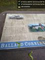
Ballard Corners park @47.6746,-122.3792

