Difference between revisions of "2022-09-09 54 -2"
From Geohashing
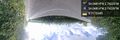
([live picture]My first hash since lockdown :) [https://openstreetmap.org/?mlat=54.04814280&mlon=-2.74239130&zoom=16 @54.0481,-2.7424]) |
(Hope I got this right… hard to edit on mobile.) |
||
| Line 1: | Line 1: | ||
<!-- If you did not specify these parameters in the template, please substitute appropriate values for IMAGE, LAT, LON, and DATE (YYYY-MM-DD format) | <!-- If you did not specify these parameters in the template, please substitute appropriate values for IMAGE, LAT, LON, and DATE (YYYY-MM-DD format) | ||
| − | |||
| − | |||
Remove this section if you don't want an image at the top (left) of your report. You should remove the "Image:" or "File:" | Remove this section if you don't want an image at the top (left) of your report. You should remove the "Image:" or "File:" | ||
| Line 13: | Line 11: | ||
}}<!-- edit as necessary --> | }}<!-- edit as necessary --> | ||
== Location == | == Location == | ||
| − | + | On Postern Gate Road, near Great Ugly Clough Wood | |
== Participants == | == Participants == | ||
<!-- who attended: If you link to your wiki user name in this section, your expedition will be picked up by the various statistics generated for geohashing. You may use three tildes ~ as a shortcut to automatically insert the user signature of the account you are editing with. | <!-- who attended: If you link to your wiki user name in this section, your expedition will be picked up by the various statistics generated for geohashing. You may use three tildes ~ as a shortcut to automatically insert the user signature of the account you are editing with. | ||
--> | --> | ||
| + | * [[User:Angel|Angel]] ([[User talk:Angel|talk]]) | ||
== Plans == | == Plans == | ||
<!-- what were the original plans --> | <!-- what were the original plans --> | ||
| + | Walk out to the hash; maybe keep going to Caton, and grab lunch at Woodies (Crook o' Lune) on the way home. | ||
== Expedition == | == Expedition == | ||
<!-- how it all turned out. your narrative goes here. --> | <!-- how it all turned out. your narrative goes here. --> | ||
| − | |||
*On my way now, after wasting 15 minutes because I forgot my phone's belt clip. | *On my way now, after wasting 15 minutes because I forgot my phone's belt clip. | ||
| Line 32: | Line 31: | ||
== Tracklog == | == Tracklog == | ||
<!-- if your GPS device keeps a log, you may use Template:Tracklog, post a link here, or both --> | <!-- if your GPS device keeps a log, you may use Template:Tracklog, post a link here, or both --> | ||
| + | [https://www.relive.cc/view/vRO7gpkpYyO A GPS track with an animated video of my walk on Relive] | ||
== Photos == | == Photos == | ||
| Line 53: | Line 53: | ||
<!-- ==REQUEST FOR TWITTER BOT== Please leave either the New report or the Expedition planning category in as long as you work on it. This helps the twitter bot a lot with announcing the right outcome at the right moment. --> | <!-- ==REQUEST FOR TWITTER BOT== Please leave either the New report or the Expedition planning category in as long as you work on it. This helps the twitter bot a lot with announcing the right outcome at the right moment. --> | ||
| − | |||
| − | |||
| − | |||
| − | |||
| − | |||
| − | + | ||
[[Category:Expeditions]] | [[Category:Expeditions]] | ||
| − | |||
[[Category:Expeditions with photos]] | [[Category:Expeditions with photos]] | ||
| − | |||
| − | |||
| − | |||
| − | |||
| − | |||
[[Category:Coordinates reached]] | [[Category:Coordinates reached]] | ||
| − | |||
| − | |||
| − | |||
| − | |||
| − | |||
| − | |||
| − | |||
| − | |||
| − | |||
| − | |||
| − | |||
| − | |||
| − | |||
| − | |||
| − | |||
| − | |||
| − | |||
| − | |||
Revision as of 20:42, 9 September 2022
| Fri 9 Sep 2022 in 54,-2: 54.0481390, -2.7423466 geohashing.info google osm bing/os kml crox |
Location
On Postern Gate Road, near Great Ugly Clough Wood
Participants
Plans
Walk out to the hash; maybe keep going to Caton, and grab lunch at Woodies (Crook o' Lune) on the way home.
Expedition
- On my way now, after wasting 15 minutes because I forgot my phone's belt clip.
-- Angel (talk) @54.0447,-2.7862 10:50, 9 September 2022 (GMT+01:00)
- Further delayed by my health, but almost there now. -- Angel (talk) @54.0439,-2.7563 11:58, 9 September 2022 (GMT+01:00)
Tracklog
A GPS track with an animated video of my walk on Relive
Photos
My first hash since lockdown :) @54.0481,-2.7424