Difference between revisions of "2022-12-30 47 -122"
From Geohashing
([live picture]Pass through [https://openstreetmap.org/?mlat=47.62752410&mlon=-122.12570790&zoom=16 @47.6275,-122.1257]) |
([live picture]Pass through [https://openstreetmap.org/?mlat=47.62752410&mlon=-122.12570790&zoom=16 @47.6275,-122.1257]) |
||
| Line 34: | Line 34: | ||
Image:2022-12-30_47_-122_thomcat_1672429983291.jpg|Pass through [https://openstreetmap.org/?mlat=47.62752410&mlon=-122.12570790&zoom=16 @47.6275,-122.1257] | Image:2022-12-30_47_-122_thomcat_1672429983291.jpg|Pass through [https://openstreetmap.org/?mlat=47.62752410&mlon=-122.12570790&zoom=16 @47.6275,-122.1257] | ||
| + | |||
| + | Image:2022-12-30_47_-122_thomcat_1672429981045.jpg|Pass through [https://openstreetmap.org/?mlat=47.62752410&mlon=-122.12570790&zoom=16 @47.6275,-122.1257] | ||
</gallery> | </gallery> | ||
Revision as of 19:53, 30 December 2022
| Fri 30 Dec 2022 in Seattle: 47.6275231, -122.1238130 geohashing.info google osm bing/os kml crox |
Location
Sidewalk of NE 19th Place in the northeast Bellevue.
Participants
Plans
Visit mid-day, also explore trail one street west leading to Interlake HS baseball field.
Expedition
Tracklog
Photos
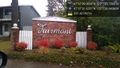
Fairmont @47.6255,-122.1242

Geohasher @47.6275,-122.1238
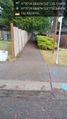
Pass through @47.6275,-122.1257

Pass through @47.6275,-122.1257


