Difference between revisions of "2023-07-02 30 -97"
From Geohashing
Enjoythecode (talk | contribs) (→Photos) |
Enjoythecode (talk | contribs) (→Achievements) |
||
| Line 45: | Line 45: | ||
== Achievements == | == Achievements == | ||
{{#vardefine:ribbonwidth|100%}} | {{#vardefine:ribbonwidth|100%}} | ||
| − | + | ||
| + | {{land geohash | latitude = 30 | longitude = -97 | date = 2023-07-02 | name = enjoythecode and ebru | image = 20230702_30_-97 usAtHash.jpg }} | ||
__NOTOC__ | __NOTOC__ | ||
| − | |||
| − | |||
| − | |||
| − | |||
| − | |||
| − | |||
| − | |||
| − | |||
| − | |||
| − | |||
| − | |||
[[Category:Expeditions]] | [[Category:Expeditions]] | ||
| − | |||
[[Category:Expeditions with photos]] | [[Category:Expeditions with photos]] | ||
| − | |||
| − | |||
| − | |||
| − | |||
| − | |||
[[Category:Coordinates reached]] | [[Category:Coordinates reached]] | ||
| − | |||
| − | |||
| − | |||
| − | |||
| − | |||
| − | |||
| − | |||
| − | |||
| − | |||
| − | |||
| − | |||
| − | |||
| − | |||
| − | |||
| − | |||
| − | |||
| − | |||
| − | |||
Revision as of 01:53, 3 July 2023
| Sun 2 Jul 2023 in 30,-97: 30.2552030, -97.5522493 geohashing.info google osm bing/os kml crox |
Location
30 meters off Webberville Rd in Austin, Texas, USA
Participants
Plans
Expedition
We were across Austin to pick up something from Facebook Marketplace, and then drove over to the hash, which I had surveyed to be not too far into a field. I was not able to park right next to the hash on the road safely, so we had to walk some 300 meters to be able to take photos at this rather understated geohash. We made the track back to the car (gotta love Texan transportation options!) and headed to Olive Garden for a reward, regardless of whether we deserved it :P
Tracklog
Photos
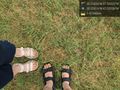
made it! @30.2552,-97.5523

perhaps my unruly hair should be my hashcot...


Achievements
enjoythecode and ebru earned the Land geohash achievement
|