Difference between revisions of "2023-09-27 -37 145"
| Line 68: | Line 68: | ||
==Photos== | ==Photos== | ||
<gallery heights="300px" mode="packed"> | <gallery heights="300px" mode="packed"> | ||
| − | File:PXL_20230927_081958484.jpg | + | File:PXL_20230927_081958484.jpg|Leaving Lysterfield |
| − | File:PXL_20230927_081453393.jpg | + | File:PXL_20230927_081453393.jpg|Big mob of wallabies. I took the right path, then realised I'd gone wrong, and had to disturb them twice. |
| − | File:PXL_20230927_080057378.jpg | + | File:PXL_20230927_080057378.jpg|Surprise deer farm! |
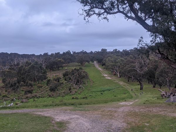
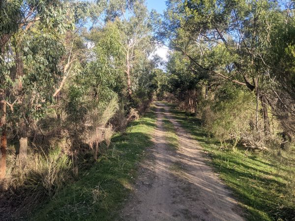
| − | File:PXL_20230927_075641977.jpg | + | File:PXL_20230927_075641977.jpg|Around the middle of Lysterfield. |
| − | File:PXL_20230927_075139340.jpg | + | File:PXL_20230927_075139340.jpg|Soft evening light. |
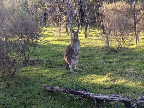
| − | File:PXL_20230927_075136356.jpg | + | File:PXL_20230927_075136356.jpg|Burly kangaroo |
| − | File:PXL_20230927_072327241.jpg | + | File:PXL_20230927_072327241.jpg|Next to the hash |
| − | File:PXL_20230927_072113450.jpg | + | File:PXL_20230927_072113450.jpg|The hash |
| − | File:PXL_20230927_072106076.jpg | + | File:PXL_20230927_072106076.jpg|Success! |
| − | File:PXL_20230927_071243642.jpg | + | File:PXL_20230927_071243642.jpg|Cyclocross bikes not recommended |
| − | File:PXL_20230927_071013520.jpg | + | File:PXL_20230927_071013520.jpg|The high point in Lysterfield |
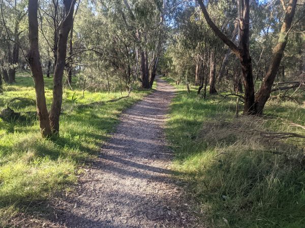
| − | File:PXL_20230927_065215662.jpg | + | File:PXL_20230927_065215662.jpg|So many singletracks |
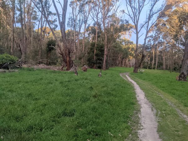
| − | File:PXL_20230927_065104822.jpg | + | File:PXL_20230927_065104822.jpg|So many wallabies |
| − | File:PXL_20230927_064858593.jpg | + | File:PXL_20230927_064858593.jpg|Into Churchill |
| − | File:PXL_20230927_064020310.jpg | + | File:PXL_20230927_064020310.jpg|Churchill |
| − | File:PXL_20230927_063341072.jpg | + | File:PXL_20230927_063341072.jpg|Along the Dandenong Creek Trail |
| − | File:PXL_20230927_063052402.jpg | + | File:PXL_20230927_063052402.jpg|Horses along the trail |
| − | File:PXL_20230927_061203947.jpg | + | File:PXL_20230927_061203947.jpg|A park in Dandenong |
| − | File:PXL_20230927_061113668.jpg | + | File:PXL_20230927_061113668.jpg|I love a good business pun |
| − | File:PXL_20230927_060439372.jpg | + | File:PXL_20230927_060439372.jpg|Dandenong station |
| − | |||
</gallery> | </gallery> | ||
Revision as of 01:24, 28 September 2023
| Wed 27 Sep 2023 in -37,145: -37.9454550, 145.2750863 geohashing.info google osm bing/os kml crox |
Location
Near a mountain bike trail in Lysterfield Park, in Melbourne's east.
Participants
Expedition
Sometimes expeditions take you to places you've never heard of. Often they take you to places you've never been. Sometimes they take you through places you've been a hundred times, and yet you discover something new.
Like the Footy Festival, in the grassy carpark of the MCG. A half-hearted celebration of a sport I find as unappealing as the live country music and sausages on offer. But I'm thrilled to find the match-day entrance to Richmond Station open, saving a crossing of Punt Road.
Scooting sneakily through the station on my bike, a sudden announcement: "THE CYCLIST ON PLATFORM SIX". I quickly revert to walking. "GET OFF THE BIKE. THERE IS NO BIKE RIDING IN STATIONS. YOU MUST WALK THE BIKE. IT WILL COST YOU A LOT OF MONEY. THE CYCLIST ON PLATFORM SIX". It goes on.
Somehow I restrain myself from a last minute donut purchase and boarded. The new high capacity train fits a lot of passengers, but there's nowhere good for the bike. I wedge myself at the end of a carriage, holding the bike occy-strapped to a pole between the two carriages. Every bump causes it to bounce all over, nearly whacking the woman next to me. It is unrestful.
Riding through Dandenong I am unsettled to realise I don't think I have ever actually been to Dandenong before. The train station looks a little bit familiar, but...nothing else. One of Melbourne's biggest activity centres, but somehow I've never had a reason to be here before. Until now. But I have reason to be elsewhere.
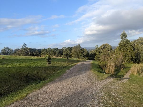
I'm quickly on a bike path leading to a bit of Dandenong Creek Trail that I've never been to. It's lovely. Wide open green spaces. Ducks feeding in a fast running channel. Lots of young gum trees doing well. Horses.
Churchill National Park brings a pang of nostalgia. The golf course my grandpa played at for decades is next door. He took me many times over the years, until his late 80s, when his vision was so poor he was having several car crashes a year getting there and back.
It's also the site of my first ever experience of GPS navigation. I'd bought a GPS and was headed to Bunyip State Park for a solo cycle tour. But my car broke down on the way, and I found myself doing a mini adventure in Churchill, camping overnight. The next morning, the GPS plotted a delightful course back to my car, and I was utterly charmed.
Today, the weather is gorgeous, it's peaceful and quiet, and I'm loving discovering all the tiny tracks through the park. Navigation isn't going so smoothly as I'm having trouble convincing my apps to take the shortest path and keep having to eyeball it.
Across a fairly busy but freshly made and smooth road, and into Lysterfield. Can it really be more than ten years since I have been here? It's at once familiar and totally new. Tiny singletrack everywhere. Joggers. A few steep climbs. A wallaby. Then another wallaby. They have joeys. It's very cute. They stare at me, and with the slightest hint of passive aggression, lollop slowly out of my path.
Now I'm at a high point, with great views all around. I head down the most direct track, and take a close look at the warning sign:
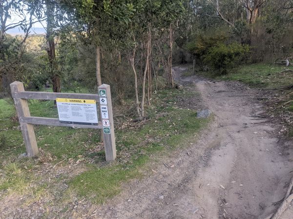
- WARNING. Very difficult downhill mountain bike trail....Use only specific Downhill or all-Mountain bikes with suitable suspension. Wear appropriate safety equipment including full face helmets...body armour, gloves, and protective glasses or goggles.
Needless to say I did not have any of that. Looking more closely at the map, I realise this is the main competition mountain bike track, a large loop used by the Commonwealth Games. I vaguely recall having ridden the whole thing before, on both my mountain bike and the cyclocross bike I'm on now. I survived that, so perhaps I will survive it now. Down I go.
It's actually fine. I'm tentative to begin with over a few rocks and roots, but quickly get comfortable and pick up the speed.
Before long it's time to hop off the track and onto a side path that takes me closer to the hash. A little bit of confused wandering later, I'm at the point. Now the real work begins.
How to get home? Back the way I came, to Dandenong? It's fine, but getting back up the hill is not straightforward as this is a one way track. And there are surely more interesting options.
Out to the Eastlink Trail then ride all the way home? I'm not certain my fitness or motivation are up to it. Stop at Ringwood Station? This seems even more underwhelming.
Eventually I decide on continuing northeast to Upwey. Many years ago I did a similar route in the opposite direction, visiting my parents in Glen Waverley. My main recollection is the ride being much harder than I expected, but I can't recall why.
I catch a bit more of the competition track, finding myself on an unsettlingly narrow boardwalk, then off onto wider tracks. There are wallabies and kangaroos everywhere. Dark, light, big, small, burly, delicate.
I make my way to the northern edge of the park where a major road cuts through. I miscalculation has me riding across untracked grass parallel to the road, which is fine at first, but then gets softer and muddier. I'm pretty surprised to be able to grind through without ever having to put a foot down, but it's a near thing.
The road crossing is terrifying. Constant high speed traffic in both directions, and there's a dip to my right giving almost no warning of approaching cars. I take the rare step of dismounting and running across when I finally get a gap.
Dargon Track is surprisingly easy and pleasant. The early evening daylight is soft and beguiling. Lovely views, and a couple of large mobs of wallabies. Where's the hard bit?
Leaving the park on the northside, I find it. A super steep gravel climb, Nixon's Road. It starts out fine, but gets steeper and steeper, and the gravel gets very loose. It's all I can do to keep my balance, weaving erratically all over the place. My heart is screaming. It's a long time since I've pushed this hard. I'm being stubborn. I really want to make it to the top. This once would have been a fun little climb, but right now it feels like a life-or-death battle. I'm pitifully looking ahead, searching for the crest that will signal an easier gradient. It comes, but I'm already a broken man.
It's not even the top, but it's enough to let me take desperate, gasping breaths as I limp onwards, upwards onto a sealed road. I'm only a few kilometres from Upwey now. The contours suggest this should be an easy ride.
It is an easy ride. Until I reach the bottom of Murray Road. Which climbs steeply up and out of sight to the left, carrying what is left of my ego with it. It's sealed, but I'm so tired and it's so steep it's a struggle to keep a straight line on the left as a series of utes passes me politely. I ponder how I got the contours so wrong. As a sometime cartographer, I wonder if there is a different design which would make them clearer. Anything to make this not my fault somehow. Up, up, up.
Another gasping summit. I try to keep the grunts as quite as possible to avoid alarming locals. I wonder whether vocalising the inhalations achieves anything more than feeling better. Feeling better sounds pretty appealing, so I go back to grunting. Too bad for the locals.
I finally get the roll down into Upwey and find the station minutes before a departure. I'm suddenly feeling good again. Ready for the next adventure!
Photos
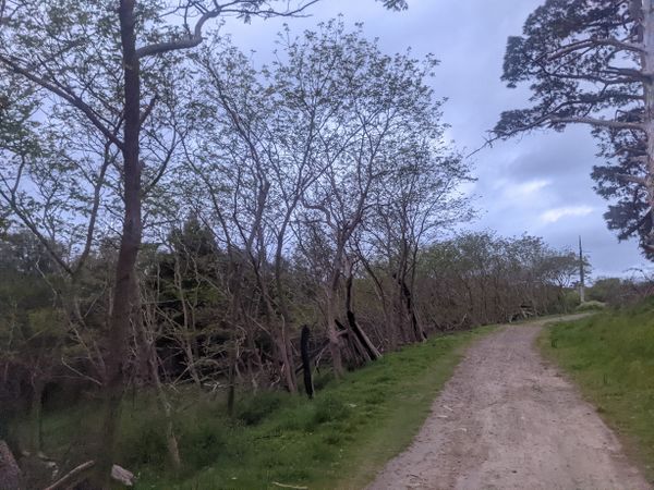
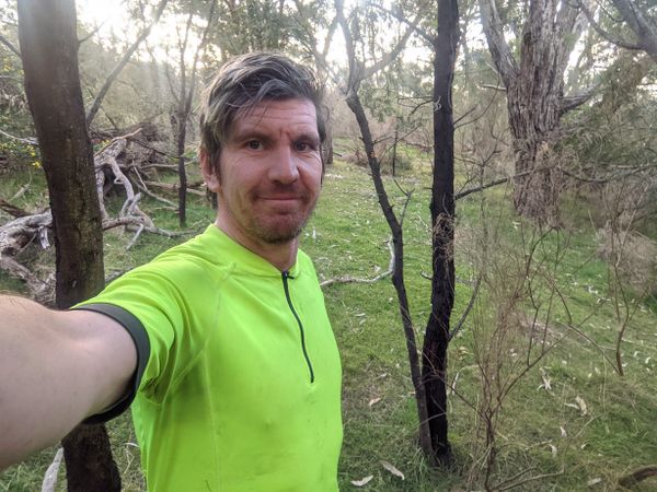
Leaving Lysterfield
Big mob of wallabies. I took the right path, then realised I'd gone wrong, and had to disturb them twice.
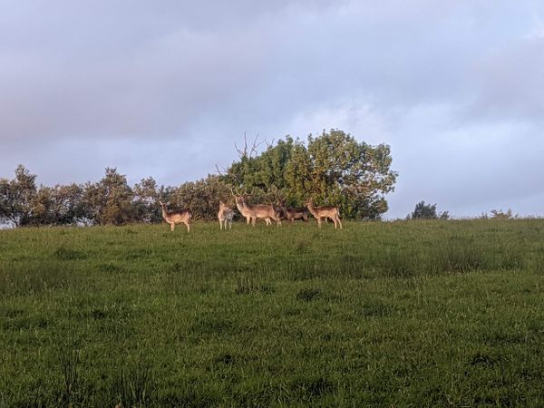
Surprise deer farm!
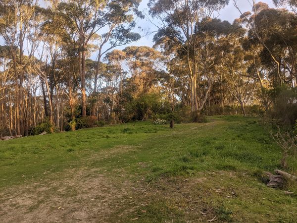
Around the middle of Lysterfield.
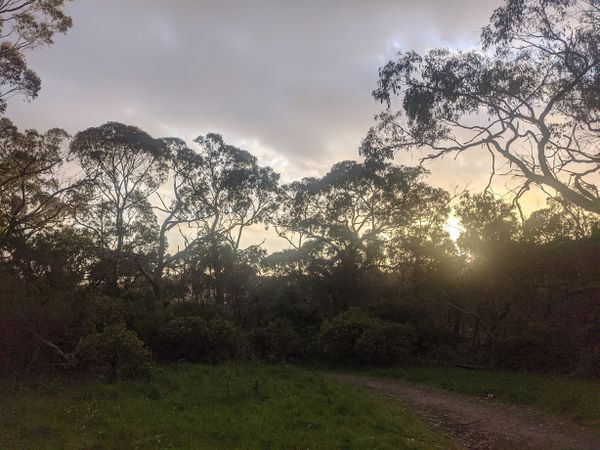
Soft evening light.
Burly kangaroo
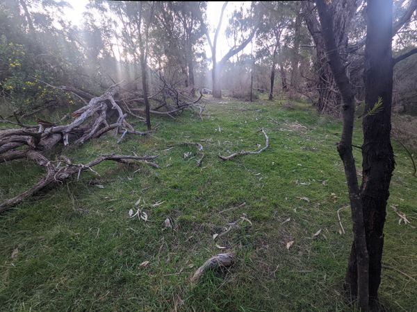
Next to the hash
The hash
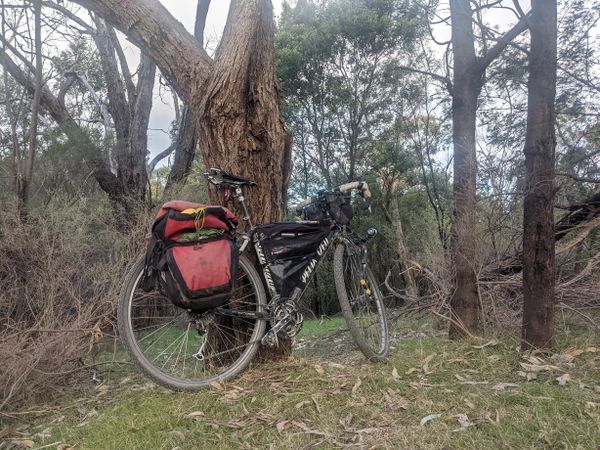
Success!
Cyclocross bikes not recommended
The high point in Lysterfield
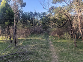
So many singletracks
So many wallabies
Into Churchill
Churchill
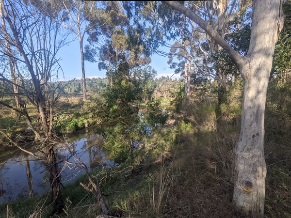
Along the Dandenong Creek Trail
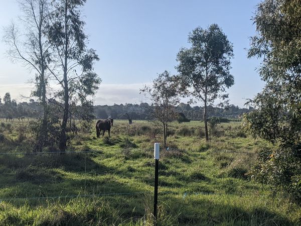
Horses along the trail
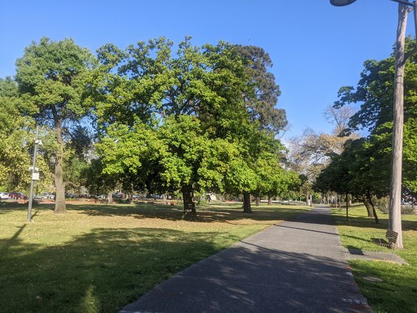
A park in Dandenong
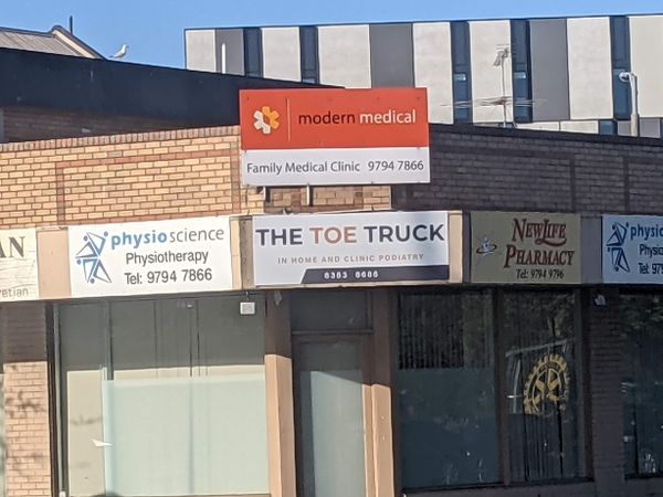
I love a good business pun
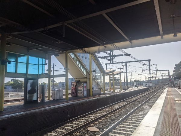
Dandenong station


Achievements
Stevage earned the Bicycle geohash achievement
|