Difference between revisions of "2024-02-19 53 10"
([retro picture]The other side of the weird excavation site from the ramp. What are they doing here‽) |
(reportify) |
||
| Line 1: | Line 1: | ||
| − | + | {{meetup graticule | |
| + | | lat={{#explode:{{SUBPAGENAME}}| |1}} | ||
| + | | lon={{#explode:{{SUBPAGENAME}}| |2}} | ||
| + | | date={{#explode:{{SUBPAGENAME}}| |0}} | ||
| + | }} | ||
| − | + | ==Location== | |
| + | in some vegetation next to a path in Wilstedt, Tangstedt, Schleswig-Holstein | ||
| − | + | ==Participants== | |
| − | + | *[[User:π π π|π π π]] ([[User talk:π π π|talk]]) | |
| − | + | ==Expedition== | |
| − | + | Cycled here in the rain. Found the hash next to the street in some tall grass. Pinns had way too much fun, he should really get out more. Then explored a huge ramp made of earth on an excavation site on the opposite side of the street. It basically consisted entirely of mud, my feet often sank in several decimetres. Made it to the top, the view was disappointing. My shoes still haven't recovered. What's this thing for? So many questions. | |
| − | |||
| − | |||
| − | |||
| − | |||
| − | |||
| − | |||
| − | + | Full report to come, though except more detail and the precise distances (yes, those are important) there's not much to add. | |
| − | |||
| − | |||
| − | |||
| − | |||
| − | |||
| − | |||
| − | |||
| − | |||
| − | |||
| − | |||
| − | |||
| − | |||
| − | |||
| − | |||
| − | |||
| − | |||
| − | |||
| + | ==Photos== | ||
| + | <gallery mode="packed" heights="150px"> | ||
Image:2024-02-19_53_10_π π π_1709070868602.jpg|Maps | Image:2024-02-19_53_10_π π π_1709070868602.jpg|Maps | ||
| − | |||
Image:2024-02-19_53_10_π π π_1709070892163.jpg|Droid | Image:2024-02-19_53_10_π π π_1709070892163.jpg|Droid | ||
| − | |||
Image:2024-02-19_53_10_π π π_1709070979237.jpg|at the hash | Image:2024-02-19_53_10_π π π_1709070979237.jpg|at the hash | ||
| − | |||
Image:2024-02-19_53_10_π π π_1709071025167.jpg|Caption this! | Image:2024-02-19_53_10_π π π_1709071025167.jpg|Caption this! | ||
| − | |||
Image:2024-02-19_53_10_π π π_1709071063732.jpg|Pinns enjoying his rare trip outdoors | Image:2024-02-19_53_10_π π π_1709071063732.jpg|Pinns enjoying his rare trip outdoors | ||
| − | |||
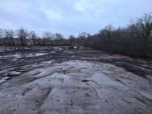
Image:2024-02-19_53_10_π π π_1709071155853.jpg|It seems flat, but look at the left! It's high up! | Image:2024-02-19_53_10_π π π_1709071155853.jpg|It seems flat, but look at the left! It's high up! | ||
| − | + | Image:2024-02-19_53_10_π π π_1709071190181.jpg|Two panoramas on one expedition? That's illegal! | |
| − | Image:2024-02-19_53_10_π π π_1709071190181.jpg| | ||
| − | |||
Image:2024-02-19_53_10_π π π_1709071237311.jpg|My shoes got a little mud on them … | Image:2024-02-19_53_10_π π π_1709071237311.jpg|My shoes got a little mud on them … | ||
| − | |||
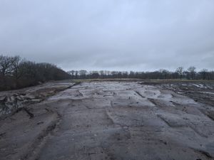
Image:2024-02-19_53_10_π π π_1709071318866.jpg|The other side of the weird excavation site from the ramp. What are they doing here‽ | Image:2024-02-19_53_10_π π π_1709071318866.jpg|The other side of the weird excavation site from the ramp. What are they doing here‽ | ||
</gallery> | </gallery> | ||
| − | == Achievements == | + | ==Achievements== |
| − | + | Land geohash, Bicycle geohash | |
| − | |||
__NOTOC__ | __NOTOC__ | ||
| − | + | [[Category:Coordinates reached]] | |
| − | + | [[Category:Land geohash achievement]] | |
| − | [[Category: | + | [[Category:Bicycle geohash achievement]] |
| − | |||
| − | |||
| − | |||
| − | |||
| − | |||
| − | [[Category: | ||
| − | |||
| − | |||
| − | |||
| − | |||
| − | |||
[[Category:Expeditions]] | [[Category:Expeditions]] | ||
| − | + | {{location|DE|SH|OD}} | |
| − | |||
| − | |||
| − | |||
| − | |||
| − | |||
| − | |||
| − | |||
| − | |||
| − | |||
| − | |||
| − | |||
| − | |||
| − | |||
| − | |||
| − | |||
| − | |||
| − | |||
| − | |||
| − | |||
| − | |||
| − | |||
| − | |||
| − | |||
| − | |||
| − | |||
Latest revision as of 22:11, 27 February 2024
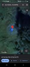
| Mon 19 Feb 2024 in 53,10: 53.7430520, 10.0499602 geohashing.info google osm bing/os kml crox |
Location
in some vegetation next to a path in Wilstedt, Tangstedt, Schleswig-Holstein
Participants
Expedition
Cycled here in the rain. Found the hash next to the street in some tall grass. Pinns had way too much fun, he should really get out more. Then explored a huge ramp made of earth on an excavation site on the opposite side of the street. It basically consisted entirely of mud, my feet often sank in several decimetres. Made it to the top, the view was disappointing. My shoes still haven't recovered. What's this thing for? So many questions.
Full report to come, though except more detail and the precise distances (yes, those are important) there's not much to add.
Photos
Maps

Droid
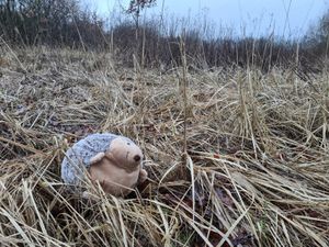
at the hash
Caption this!
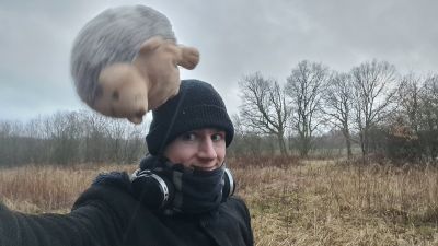
Pinns enjoying his rare trip outdoors
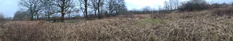
It seems flat, but look at the left! It's high up!
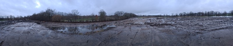
Two panoramas on one expedition? That's illegal!
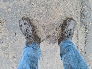
My shoes got a little mud on them …
The other side of the weird excavation site from the ramp. What are they doing here‽


Achievements
Land geohash, Bicycle geohash