Difference between revisions of "2024-03-23 -34 138"
(Created page with "{{subst:Expedition}}") |
(i think this is the longest time between going to a hash and writing the expedition for it that i've done so far) |
||
| Line 13: | Line 13: | ||
}}<!-- edit as necessary --> | }}<!-- edit as necessary --> | ||
== Location == | == Location == | ||
| − | + | A shared driveway in Mitcham | |
== Participants == | == Participants == | ||
| − | + | [[User:XXOs|XXOs]] ([[User talk:XXOs|talk]]) | |
| − | + | ||
| + | [[User:XXOs|XXOs]]'s family | ||
== Plans == | == Plans == | ||
| − | + | I noticed that today's geohash was literally within walking distance of my house, and brought this fact up with my mother. She then suggested that we could go the the geohash as a family walk, which we ended up doing in the evening. | |
== Expedition == | == Expedition == | ||
| − | + | Like most of my expeditions, there really wasn't that much out of the ordinary - aside from the fact that this time I was with my whole family. The most family members that I've had join me while geohashing prior to this point was [[2021-09-26 -34 138|my father and sibling]]. | |
| − | + | The most notable annoying thing about this walk was how windy it was - aside from that, the weather was actually quite nice. The sun had set by the time we reached the hash, so my dad very kindly used his phone light to help me take pictures. | |
| − | |||
== Photos == | == Photos == | ||
| Line 33: | Line 33: | ||
--> | --> | ||
<gallery perrow="5"> | <gallery perrow="5"> | ||
| + | Image:2024-03-23 -34 138 gogl.PNG | bing (real) | ||
| + | Image:2024-03-23 -34 138 therm.JPEG | the appropriate way to hold a [[User:XXOs/Therm|cyndaquil]] | ||
| + | Image:2024-03-23 -34 138 mailbox.JPEG | The mailbox out the front of the driveway (because it's basically impossible to tell that the previous image is of the geohash) | ||
</gallery> | </gallery> | ||
== Achievements == | == Achievements == | ||
{{#vardefine:ribbonwidth|100%}} | {{#vardefine:ribbonwidth|100%}} | ||
| − | + | {{Walk geohash | |
| + | | latitude = -34 | ||
| + | | longitude = 138 | ||
| + | | date = 2024-03-23 | ||
| + | | name = [[User:XXOs|XXOs]] | ||
| + | }} | ||
__NOTOC__ | __NOTOC__ | ||
| − | |||
| − | |||
| − | |||
<!-- ==REQUEST FOR TWITTER BOT== Please leave either the New report or the Expedition planning category in as long as you work on it. This helps the twitter bot a lot with announcing the right outcome at the right moment. --> | <!-- ==REQUEST FOR TWITTER BOT== Please leave either the New report or the Expedition planning category in as long as you work on it. This helps the twitter bot a lot with announcing the right outcome at the right moment. --> | ||
| − | |||
| − | |||
| − | |||
| − | |||
| − | |||
| − | |||
| − | |||
| − | |||
| − | |||
[[Category:Expeditions]] | [[Category:Expeditions]] | ||
| − | |||
[[Category:Expeditions with photos]] | [[Category:Expeditions with photos]] | ||
| − | |||
| − | |||
| − | |||
| − | |||
| − | |||
[[Category:Coordinates reached]] | [[Category:Coordinates reached]] | ||
| − | |||
| − | |||
| − | |||
| − | |||
| − | |||
| − | |||
| − | |||
| − | |||
| − | |||
| − | |||
| − | |||
| − | |||
| − | |||
| − | |||
| − | |||
| − | |||
| − | |||
| − | |||
Revision as of 03:36, 27 March 2024
| Sat 23 Mar 2024 in -34,138: -34.9859025, 138.6037936 geohashing.info google osm bing/os kml crox |
Location
A shared driveway in Mitcham
Participants
XXOs's family
Plans
I noticed that today's geohash was literally within walking distance of my house, and brought this fact up with my mother. She then suggested that we could go the the geohash as a family walk, which we ended up doing in the evening.
Expedition
Like most of my expeditions, there really wasn't that much out of the ordinary - aside from the fact that this time I was with my whole family. The most family members that I've had join me while geohashing prior to this point was my father and sibling.
The most notable annoying thing about this walk was how windy it was - aside from that, the weather was actually quite nice. The sun had set by the time we reached the hash, so my dad very kindly used his phone light to help me take pictures.
Photos
bing (real)
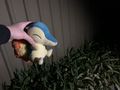
the appropriate way to hold a cyndaquil
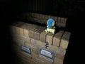
The mailbox out the front of the driveway (because it's basically impossible to tell that the previous image is of the geohash)


Achievements
XXOs earned the Walk geohash Achievement
|