Difference between revisions of "2024-04-23 47 8"
From Geohashing
Globescorer (talk | contribs) (→Plans) |
Globescorer (talk | contribs) (→Photos) |
||
| Line 20: | Line 20: | ||
File:2024-04-23 47 8 Husemersee 1.jpg |view to the nature reserve Husemersee | File:2024-04-23 47 8 Husemersee 1.jpg |view to the nature reserve Husemersee | ||
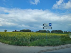
File:2024-04-23 47 8 sign.jpg |Sign at the parking | File:2024-04-23 47 8 sign.jpg |Sign at the parking | ||
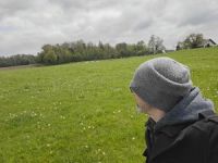
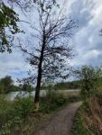
| − | File:2024-04-23 47 8 The Geohash.jpg |The geohash | + | File:2024-04-23 47 8 The Geohash.jpg |The geohash himself |
File:2024-04-23 47 8 selfie.jpg |selfie | File:2024-04-23 47 8 selfie.jpg |selfie | ||
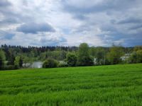
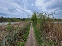
File:2024-04-23 47 8 panorama.jpg |Panorama | File:2024-04-23 47 8 panorama.jpg |Panorama | ||
Revision as of 22:12, 23 April 2024
| Tue 23 Apr 2024 in 47,8: 47.6238713, 8.7130123 geohashing.info google osm bing/os kml crox |
Location
This Geohash is located next to a gravel road near Ossingen (ZH) close to the Husemersee.
Participants
Plans
going there in my free afternoon before I collect my kids by their grandmother...
Expedition
Success!
Report to come...
Photos
parking lot is near...

view to the nature reserve Husemersee

Sign at the parking

The geohash himself
selfie

Panorama

Proof 1

Proof 2

north

west

south

east

Entrance

welcome to the coffee shop

inside
view to the Husemersee

nice place
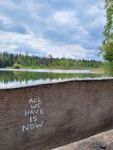
"All we have is now"...
beavertree
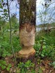
beaver signs

Husemersee eastside

Husemersee westside

Situation
trial


Ribbons
globescorer earned the Land geohash achievement
|