File:2008-09-01 47 -122 Map and compass.jpg
From Geohashing
Revision as of 17:59, 21 September 2020 by FippeBot (talk | contribs) (Replacing Category:GPS receivers with Category:GNSS receivers)
No higher resolution available.
2008-09-01_47_-122_Map_and_compass.jpg (495 × 549 pixels, file size: 246 KB, MIME type: image/jpeg)
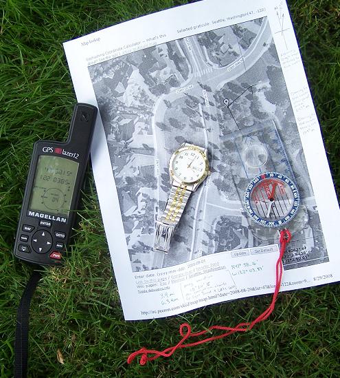
Map with computations and compass used to location hash point. GPS showing somewhat innacurate readings (about 100 ft error).
File history
Click on a date/time to view the file as it appeared at that time.
| Date/Time | Thumbnail | Dimensions | User | Comment | |
|---|---|---|---|---|---|
| current | 16:19, 30 January 2020 | | 495 × 549 (246 KB) | Maintenance script (talk | contribs) |
- You cannot overwrite this file.
File usage
The following page links to this file: