File:2009-03-07 -36 144 mdb 009.jpg
From Geohashing
Revision as of 16:34, 30 January 2020 by Maintenance script (talk | contribs) (Maintenance script uploaded File:2009-03-07 -36 144 mdb 009.jpg)
Size of this preview: 500 × 599 pixels. Other resolutions: 200 × 240 pixels | 549 × 658 pixels.
Original file (549 × 658 pixels, file size: 54 KB, MIME type: image/jpeg)
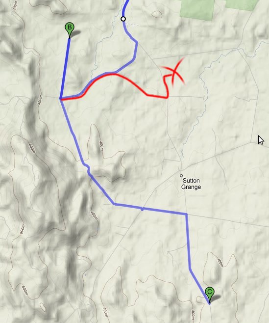
Google Map's route in blue, vs the 'return' route I took to the winery in red.
B is the closest road to the hash. Location C is where google thinks the winery is, based on the exact address. The red cross is the actual location.
For scale: According to Google, the trip from B to C is 10.4 Km
File history
Click on a date/time to view the file as it appeared at that time.
| Date/Time | Thumbnail | Dimensions | User | Comment | |
|---|---|---|---|---|---|
| current | 16:34, 30 January 2020 | | 549 × 658 (54 KB) | Maintenance script (talk | contribs) |
- You cannot overwrite this file.
File usage
The following page links to this file: