File:200921002 34 -84NW20.JPG
From Geohashing
Revision as of 21:39, 21 September 2020 by FippeBot (talk | contribs) (Replacing Category:GPS receivers with Category:GNSS receivers)
No higher resolution available.
200921002_34_-84NW20.JPG (640 × 480 pixels, file size: 132 KB, MIME type: image/jpeg)
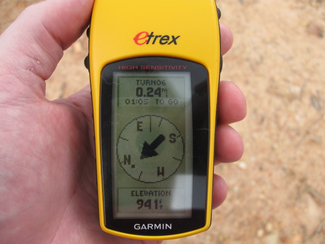
The highest point in the area at 941 feet above sea level 0.24 miles away from the Geohash spot.
File history
Click on a date/time to view the file as it appeared at that time.
| Date/Time | Thumbnail | Dimensions | User | Comment | |
|---|---|---|---|---|---|
| current | 15:01, 30 January 2020 | | 640 × 480 (132 KB) | Maintenance script (talk | contribs) |
- You cannot overwrite this file.
File usage
The following page links to this file: