File:2013-12-25 35 -118 14-38-49-292.jpg
From Geohashing
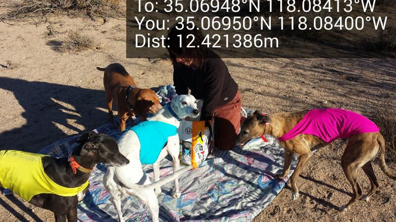
Revision as of 22:38, 25 December 2013 by imported>Bravissimo594 (Interference with the picnic. [http://www.openstreetmap.org/?lat=35.06950000&lon=-118.08400000&zoom=16&layers=B000FTF @35.0695,-118.0840] Category:Meetup on 2013-12-25 Category:Meetup in 35 -118)
No higher resolution available.
2013-12-25_35_-118_14-38-49-292.jpg (800 × 450 pixels, file size: 109 KB, MIME type: image/jpeg)
Interference with the picnic. @35.0695,-118.0840
File history
Click on a date/time to view the file as it appeared at that time.
| Date/Time | Thumbnail | Dimensions | User | Comment | |
|---|---|---|---|---|---|
| current | 16:25, 30 January 2020 | | 800 × 450 (109 KB) | Maintenance script (talk | contribs) |
- You cannot overwrite this file.
File usage
The following 7 pages link to this file: