File:2018-12-19 51 5 map.jpg
From Geohashing

Size of this preview: 800 × 600 pixels. Other resolutions: 320 × 240 pixels | 2,048 × 1,536 pixels.
Original file (2,048 × 1,536 pixels, file size: 742 KB, MIME type: image/jpeg)
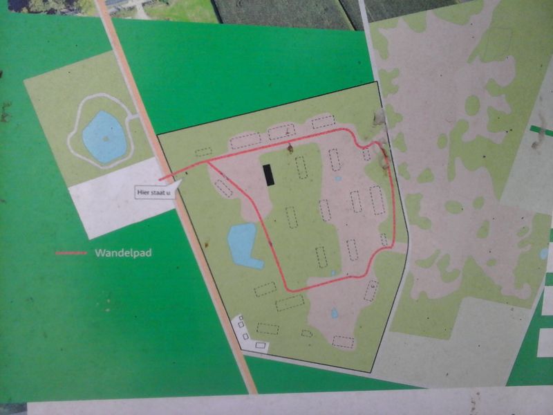
A map of the base. The dotted rectangles indicate where the barracks were, all but the black one have been demolished. The hashpoint was somewhere close to the location of the 3rd barracks north of the road.
File history
Click on a date/time to view the file as it appeared at that time.
| Date/Time | Thumbnail | Dimensions | User | Comment | |
|---|---|---|---|---|---|
| current | 16:24, 30 January 2020 | | 2,048 × 1,536 (742 KB) | Maintenance script (talk | contribs) |
- You cannot overwrite this file.
File usage
The following 2 pages link to this file:
- 2018-12-19 51 5
- File:2012-12-19 51 5 map.jpg (file redirect)