Difference between revisions of "GPS receivers"
imported>Danatar (→Other GPS) |
m |
||
| (6 intermediate revisions by 6 users not shown) | |||
| Line 1: | Line 1: | ||
| − | I expect someone to take up the cause and flesh out this page with information on the features, advantages and disadvantages of various | + | I expect someone to take up the cause and flesh out this page with information on the features, advantages and disadvantages of various GPS (or more widely/generically, GNSS) receivers, but for now, I'm collecting pictures. Please add any different kinds (or better shots of the same kind) or details on these. (see also: [[osmwiki:GPS device reviews]]) |
| − | ==Have a Look== | + | |
| − | ===[[ | + | == Have a Look == |
| + | |||
| + | === [[wikipedia:Garmin|Garmin]] === | ||
| + | |||
<gallery> | <gallery> | ||
Image:2008-05-24_53_6_143.jpg|Garmin [[Wikipedia:eTrex|eTrex]] (hiking) | Image:2008-05-24_53_6_143.jpg|Garmin [[Wikipedia:eTrex|eTrex]] (hiking) | ||
| Line 15: | Line 18: | ||
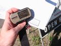
Image:2008-06-28 GPS Proof.jpg|Garmin GPSIII. Available in road and aviation versions. Monochrome, high quality receiver, 3 metre accuracy. | Image:2008-06-28 GPS Proof.jpg|Garmin GPSIII. Available in road and aviation versions. Monochrome, high quality receiver, 3 metre accuracy. | ||
</gallery> | </gallery> | ||
| + | |||
===Magellan GPS=== | ===Magellan GPS=== | ||
| Line 20: | Line 24: | ||
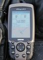
Image:2008-09-11 49 -123 gps.jpg|[[Wikipedia:Magellan Navigation|Magellan explorist]] | Image:2008-09-11 49 -123 gps.jpg|[[Wikipedia:Magellan Navigation|Magellan explorist]] | ||
File:2010-05-25_49_9_gps.jpg|Magellan Triton ?00 series (here a 500) | File:2010-05-25_49_9_gps.jpg|Magellan Triton ?00 series (here a 500) | ||
| + | Image:Magellen Trailblazer.jpg|Magellen Trailblazer. Old school, mid 1990's | ||
</gallery> | </gallery> | ||
| − | |||
===Other GPS=== | ===Other GPS=== | ||
| Line 29: | Line 33: | ||
Image:Img 3149.jpg|[[Wikipedia:TomTom|Tomtom]] | Image:Img 3149.jpg|[[Wikipedia:TomTom|Tomtom]] | ||
Image:Holux gpslim240.jpg|Holux GPSlim240 | Image:Holux gpslim240.jpg|Holux GPSlim240 | ||
| − | |||
File:2010-01-06 49 8 reached.jpg|NavGear GP-43 | File:2010-01-06 49 8 reached.jpg|NavGear GP-43 | ||
File:Topcon GRS-1 DPOS.jpg|Topcon GRS-1 (decimeter resolution) | File:Topcon GRS-1 DPOS.jpg|Topcon GRS-1 (decimeter resolution) | ||
| Line 35: | Line 38: | ||
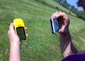
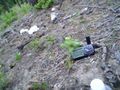
[[File:2010-05-22_49_9_gps.jpg|thumb|200px|left|alt=Holux M-241.|Holux M-241]] | [[File:2010-05-22_49_9_gps.jpg|thumb|200px|left|alt=Holux M-241.|Holux M-241]] | ||
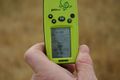
| − | ''Description:'' | + | ''Description:'' The Holux M-241 is a GPS logger and thus its primary use is to log many many trackpoints, not to find places (but that works, too). In contrast to other GPS loggers, it has a small (128x32 pixel) LCD screen and shows: Remaining memory for trackpoints; time; LAT and LON in dd° mm' ss.ss" format; current heading / speed / height; distance from start. It can save more than 100 000 trackpoints, each consisting of LAT, LON, height, time and (with newest firmware version) speed. The M-241 saves trackpoints either by time (every 1/5/10/15/30/60/120 seconds) or by distance (every 50/100/150/300/500/1000 metres or feet). Connection to a computer can be done by bluetooth or USB. This device looks like a yellow film canister (Those of you who still have memories from the analog camera era will know what that is. Sorry kids...) and is NOT water proof. One AA rechargeable battery lasts for 10-12 hours. It has a MTK chipset and a good accuracy. |
| + | |||
| + | ''Opinion ([[User:Danatar|Danatar]]):'' I use the Holux M-241 as a secondary GPSr for those times when my other GPSr is out of batteries and to log the track a second time. It even worked on a commercial airplane, but only directly next to the window. It failed me once, when during one week of vacation it only logged one single position per track; Erasing the memory fixed that. | ||
| − | |||
===Aviation & Nautical=== | ===Aviation & Nautical=== | ||
| Line 46: | Line 50: | ||
Image:2008-06-08 the spot.jpg|Garmin GPSIII Pilot. Aviation version of the GPSIII. | Image:2008-06-08 the spot.jpg|Garmin GPSIII Pilot. Aviation version of the GPSIII. | ||
</gallery> | </gallery> | ||
| + | |||
| + | |||
===Cell Phone=== | ===Cell Phone=== | ||
<gallery> | <gallery> | ||
| Line 54: | Line 60: | ||
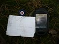
Image:2009_06_21_Norse_14.jpg|T-Mobile G1 (smartphone) | Image:2009_06_21_Norse_14.jpg|T-Mobile G1 (smartphone) | ||
Image:200908055213-P1040487.JPG|HTC Magic "G2" (smartphone) | Image:200908055213-P1040487.JPG|HTC Magic "G2" (smartphone) | ||
| + | Image:2010-09-09 39 -108 coordinates.JPG|Motorola Droid X (smartphone) | ||
</gallery> | </gallery> | ||
| Line 63: | Line 70: | ||
Image:080522Stoughtonpic1.jpg|Unknown, built into a car | Image:080522Stoughtonpic1.jpg|Unknown, built into a car | ||
Image:Pardey-Geohash-2008-10-13-001.jpg|Nokia 770 (with bluetooth GPS and Maemo Mapper software) | Image:Pardey-Geohash-2008-10-13-001.jpg|Nokia 770 (with bluetooth GPS and Maemo Mapper software) | ||
| + | Image:45_9_PSP.jpg | A PlayStation Portable with a GPS receiver | ||
</gallery> | </gallery> | ||
[[Category:Technology]] | [[Category:Technology]] | ||
| − | |||
[[Category:Fun stuff]] | [[Category:Fun stuff]] | ||
[[Category:Galleries by topic]] | [[Category:Galleries by topic]] | ||
| + | [[Category:Geohashing guide]] | ||
Latest revision as of 10:46, 21 October 2021
I expect someone to take up the cause and flesh out this page with information on the features, advantages and disadvantages of various GPS (or more widely/generically, GNSS) receivers, but for now, I'm collecting pictures. Please add any different kinds (or better shots of the same kind) or details on these. (see also: osmwiki:GPS device reviews)
Contents
Have a Look
Garmin
Garmin eTrex (hiking)
Garmin eTrex legend (hiking)
Garmin eTrex Vista
Garmin eTrex Vista HCx
Garmin foretrex 101 (running)
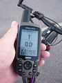
Garmin geko 201 (cycling)
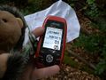
Garmin GPSmap 60CSx
Garmin GPSmap 60CS
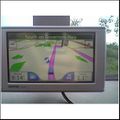
Garmin nüvi (driving)
Garmin iQue
Garmin GPSIII. Available in road and aviation versions. Monochrome, high quality receiver, 3 metre accuracy.


Magellan GPS
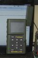
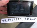
Magellan Triton ?00 series (here a 500)
Magellen Trailblazer. Old school, mid 1990's


Other GPS
Blackberry (PDA)
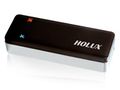
Holux GPSlim240
NavGear GP-43
Topcon GRS-1 (decimeter resolution)


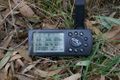
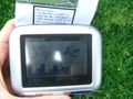
Description: The Holux M-241 is a GPS logger and thus its primary use is to log many many trackpoints, not to find places (but that works, too). In contrast to other GPS loggers, it has a small (128x32 pixel) LCD screen and shows: Remaining memory for trackpoints; time; LAT and LON in dd° mm' ss.ss" format; current heading / speed / height; distance from start. It can save more than 100 000 trackpoints, each consisting of LAT, LON, height, time and (with newest firmware version) speed. The M-241 saves trackpoints either by time (every 1/5/10/15/30/60/120 seconds) or by distance (every 50/100/150/300/500/1000 metres or feet). Connection to a computer can be done by bluetooth or USB. This device looks like a yellow film canister (Those of you who still have memories from the analog camera era will know what that is. Sorry kids...) and is NOT water proof. One AA rechargeable battery lasts for 10-12 hours. It has a MTK chipset and a good accuracy.
Opinion (Danatar): I use the Holux M-241 as a secondary GPSr for those times when my other GPSr is out of batteries and to log the track a second time. It even worked on a commercial airplane, but only directly next to the window. It failed me once, when during one week of vacation it only logged one single position per track; Erasing the memory fixed that.
Aviation & Nautical
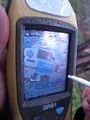
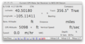
Garmin 496 (aviation)
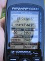
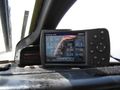
Lowrance Airmap 600c (aviation)
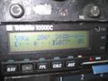
Trimble 1000DC (aviation)
Garmin GPSIII Pilot. Aviation version of the GPSIII.


Cell Phone
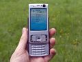
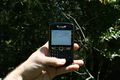
Nokia (cellphone)
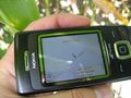
Nokia (cellphone)
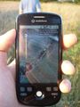
Sony Ericson (cellphone)
OpenMoko Freerunner (PDA)
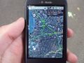
T-Mobile G1 (smartphone)
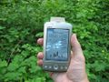
HTC Magic "G2" (smartphone)
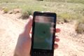
Motorola Droid X (smartphone)


Miscellany
Macintosh (computer)
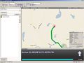
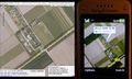
Microsoft Streets & Trips (computer software)
Unknown
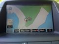
Unknown, built into a car
Nokia 770 (with bluetooth GPS and Maemo Mapper software)
A PlayStation Portable with a GPS receiver


