Difference between revisions of "User:Johnwrw"
imported>Johnwrw (→2013 Expeditions) |
imported>Johnwrw (→Geohash Achievements) |
||
| Line 40: | Line 40: | ||
| latitude = -37 | | latitude = -37 | ||
| longitude = 144 | | longitude = 144 | ||
| − | | date = | + | | date = 2013-06-28 |
| name = [[User:Johnwrw|Johnwrw]] | | name = [[User:Johnwrw|Johnwrw]] | ||
| image = | | image = | ||
}} | }} | ||
Revision as of 11:47, 28 June 2013
Contents
About Me

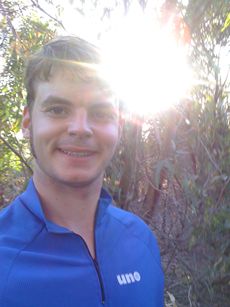
Hello, I am John, and I'm from Melbourne, I went on a couple of geohashes with friends from school in 2008, but recently I learnt that some of my uni friends (Particularly Lachie and Felix) do a bit of geohashing which rekindled my interest in it.
I created this account in order to write up my first geohash expedition after my 4 and a half year hiatus post 2008.
All Geohashes
2008 Expeditions
I don't remember that much about them, there was one in someone's front yard in Kew, after which we went for a walk in a cemetery. The other one involved a train to Hurstbridge, about a 10km ride and then a couple of hundred metre scrabble through a creek valley, probably on someone's property. Both didn't involve GPS, google maps satellite images were our main resources.
2013 Expeditions
![]() 2013-03-24 -37 144 Just across the Werribee River from Werribee Open Range Zoo.
2013-03-24 -37 144 Just across the Werribee River from Werribee Open Range Zoo.
![]() 2013-06-23 -37 144 Just off Merri Creek trail near Rushall Station.
2013-06-23 -37 144 Just off Merri Creek trail near Rushall Station.
![]() 2013-06-28 -37 144 Derrimut, in the middle of the mess of Freeway at the intersection of the Western Ring Road and the Western Hwy.
2013-06-28 -37 144 Derrimut, in the middle of the mess of Freeway at the intersection of the Western Ring Road and the Western Hwy.
Geohash Achievements
Johnwrw earned the Bicycle geohash achievement
|
Johnwrw earned the Land geohash achievement
|
Johnwrw earned the Hashcat achievement
|