2008-06-29 53 9
| Sun 29 Jun 2008 in 53,9: 53.6080460, 9.5754466 geohashing.info google osm bing/os kml crox |
About
The coordinates of this geohash are
53.608045962575794, 9.575446623441385
It's in the middle of the river Elbe.
Expedition
Hermann was there:
I called everyone I knew who had a boat, but no one had spare time or an actually swimming boat so I needed to get as close as possible by bike. I took my standard route behind the dike. I really like the road there. It's like switching off your brain and just cycling. Some meditation expert may discover a way to workout while sleeping running down the road.
After a couple of kilometres I stopped at a small moorage and asked three shipowners if they could take me to the hash. The first replied that I was late since he didn't want to miss the European Soccer Cup Finals and that sailing to that point was a supid idea anyway, the second one refused to speak to me and the third one asked where the coordinates are and then said no.
I saw the pylons from far away. They are really impressive because there is not much standing around them that could make them look small. They seem incredibly huge, but I assume they are not even 100 metres tall. Approacing the second pylon I passed an abandoned powernode or whatever it is called. I wonder what it was used for once. Maybe there is was an underground connection before the pylons were built...
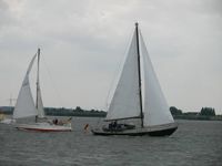
I arrived at the shore right behind the pylon and left my bike there. The tide was high so I needed to walk on the shoreline stabilisation. I made it to the second pile of stones reaching into the river (you call it "groyne", I guess) and created a marker using a brick as pencil. I walked to the end of the groyne and took photos. There were many boats on the river but obviously noone knew Geohashing nor would stop by to pick me up.
You may ask "why didn't you just swim out there?" Answer: "The current would probably force me to swim to the British Isles."
On the way back to my bike I found some sort of coloured net. I decided to build a more waterproof marker.
Technical details:
- Trip: 26.87 km
- Time: 1:42:33 h
- Mean speed: 15.72 km/h
- Geonad: approx. 455m
- Pictures
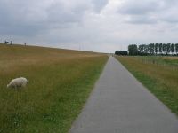
Road behind the dike
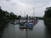
Excuse me, could you take me to 53.6080459, 9.5754466?
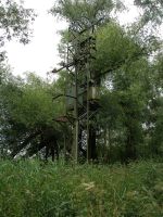
In former times, energy has been pumped out of the earth like oil...
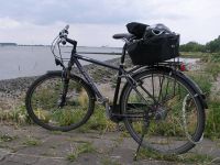
Hermann's bike

A freaking huge pylon
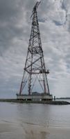
It doesn't grow smaller if you step back
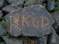
A marker

Hermann thinks that geohashing is serious business

Proof of location taken at 53.611497, 9.579143
Hey, you, over there! Do you know geohashing?
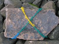
A more waterproof marker
Baaa


