2008-10-12 57 -121
| Sun 12 Oct 2008 in 57,-121: 57.4999564, -121.3972475 geohashing.info google osm bing/os kml crox |
Contents
[hide]Location
This geohash, in the Gutah, British Columbia graticule, was out in a maze of oilfield roads, near the named community of Gleam.
Participants
Robyn and the airplane she flies for work
Expedition
I had entered the coordinates of the day's geohash location into the GPS before an earlier flight, but had been too busy to check if I was actually anywhere near them, but then I was assigned to fly to Grande Prairie. I took off, turned en route and checked my GPS. I was headed straight for the geohash. I thought I must have made a mistake and hit the wrong button, but I hadn't.
I levelled off at my cruise altitude and as I approached the point, I dug out my camera. The good thing about airhashing is that you're never thwarted by an inconvenient swamp. There are other things that can thwart you, though. The light was in a bad place for getting pictures of the GPS, so I had to move the camera kind of below it to keep it from exposing on the sun instead of the equipment. It was too close and blurred. You can tell it's 57 3? and 121 23, but you can't make out any of the seconds. There's not enough detail to verify the location. I could post pictures taken approaching it, and try to claim it, but I'm thinking if this were my graticule and someone claimed to have made the first geohash here on this evidence, I wouldn't be too impressed.
So I'm logging this one as coordinates reached, because I did, but as Failed, because I failed to produce sufficient documentation to prove my presence there. Maybe I'll be back to Gutah in the future.
I did achieve other airhashes today, so it wasn't a total loss.
Photos
I even failed at photographing myself.
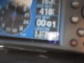
No way this is proof.
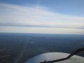
Geohash is out there somewhere.


