2009-01-29 33 -84
| Thu 29 Jan 2009 in Atlanta: 33.7087997, -84.7540967 geohashing.info google osm bing/os kml crox |
Contents
[hide]Participants
Expedition
We checked the coordinates around 10:45 in the morning, and decided that we could spare the time to attempt this hash. The hashpoint was less than an hour away, and Google Maps said it was on the easement off of a road. Sounds like a sure bet.
We pulled up to the hash around 4:30 and noticed one hitch. There was no space to park on the side of the road. After a little bit of aimless driving we found our way back to a church parking lot less than a quarter mile from the hash, and walked the final bit. And we were there! Or were we? Well, I think we were. Google Maps said we were... The fact of the matter was that the GPS unit showed the hash 300 feet farther into someone's front yard. So Nick hopped on his iPhone to double check our coordinates, only to be denied by the Geohashing App. Were we blinded by science? For the moment. But as cool as that ribbon looked, we didn't want it.

We went back to the car, Nick made some phone calls, and found the error. The GPS was off by a few ten-thousandths of a degree.
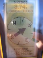
The second walk to the hashpoint was shorter than the first, and this time the GPS indeed directed us to the easement. Yay! It even displayed 0.00 feet to go, but for too brief a period to snap a picture. We gathered the customary evidence, including a shot of Chris' raptor wound. Earlier in the day Chris had had a run in with some American Red Cross velociraptors, who collected exactly one pint of his blood before bandaging his wound for him (And they did disappear fast!).
Well, successful hash and the sixth for the month of January in the Atlanta graticule. We left the point around 5:00 and picked up some stuff at Target on the way home.
Gallery
- Photo Gallery
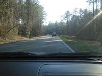
Approaching the hashpoint.
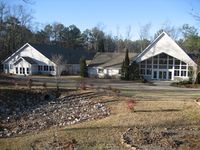
The church at which we parked.
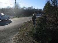
Nick approaching the point.
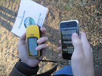
What was the deal with the coordinates?
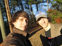
Success.
And the proof.

No Underground Geohash for us today, although some cable won.
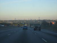
From I20, on the return trip.


Achievements
This user earned the Land geohash achievement
|