2009-05-10 66 19
| Sun 10 May 2009 in 66,19: 66.9003955, 19.8551485 geohashing.info google osm bing/os kml crox |
The hashpoint was in the forest between Porjus and Harsprånget.
the ru
I drove along E10 to Gällivare, then E45 to Porjus. The hashpoint was a bit further south, near the Harsprånget dam and power station. Google had shown a road (turned out to be Harsprångsvägen) that would take me almost all the way to the hash. There was some snow in the forest, but GEOHASHERS DO NOT FEAR SNOW.
There was a nondescript building near the hashpoint, probably an old military installation. Since there were no "don't photograph, plz" signs, I assumed no one would mind me doing so.
After finding the hashpoint, I went to have a look at the dam. It was huge.
Easy expedition, though time (6 hours) and fuel-consuming.
the ru earned the Graticule Unlocked Achievement
|
the ru achieved level 6 of the Minesweeper Geohash achievement
|
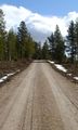
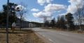
Harsprångsvägen
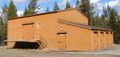
Secret bunker
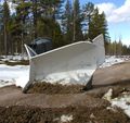
A snow plow
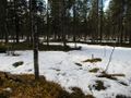
The hashpoint - not very exciting
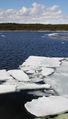
Ice floes in the Harsprånget dam
Porjus
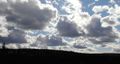
Nice weather
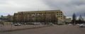
Gällivare hospital, birthplace of the ru
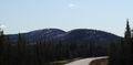
The mountains commonly referred to as "Grandmothers Boobs"


... wait, what?
So anyway, I saw a couple of signs as well:
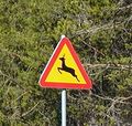
Beware of deer
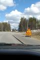
Flooding!

