2009-05-13 68 19
| Wed 13 May 2009 in 68,19: 68.2956643, 19.4288156 geohashing.info google osm bing/os kml crox |
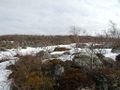
The hashpoint was on the northern shore of a cape/mountain extending into the lake Torneträsk, a few km from the Stenbacken train station (no longer in use).
the ru
I walked 10.6 km to reach this hashpoint. On the way there, I went straight across the hills. Stenbacken translates quite literally into "rocky slope" and I would have a hard time coming up with a better name for this area. I had to constantly leap between rocks or haul myself across boulders. When I reached the hashpoint I had walked 4.5 km. On the way back, I took a route some distance to the west, closer to the shore. It was longer but much easier.
Wildlife seen: I scared three ptarmigans that took off, didn't have time to get any picture of them.
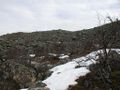
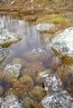
The terrain
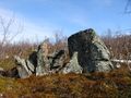
This expedition rocks!
The hashpoint
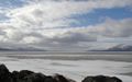
View west over Torneträsk
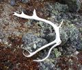
Reindeer antler
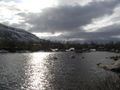
Love the colors in this one


