2009-05-31 -36 143
| Sun 31 May 2009 in -36,143: -36.9138364, 143.5325219 geohashing.info google osm bing/os kml crox |
Contents
[hide]The location
In a paddock near Natte Yallock.
Who Went?
myka
Day 2 of driving for the weekend. Like Yesterday, my normal day of traveling would take me through some 6 Graticules. 3 Hashes are within reasonable distance of my route. This is the Second.
(report written en-route, and therefore has possibly confused tenses)
Dadswell Bridge to Hash 2
My second Hash of the day would require some diversion from the standard route. I worked out that turning off at Moonambel and going through Natte Yallock instead of Avoca (with its yummy bakery, which was probably not open on sunday afternoon in any case) would not be a bad way to go. That would get me pretty close, and not far out of my way, while keeping to decent roads.
From Natte Yallock there would be a small amount of best guess based navigation required to get to the nearest road to the Hash, then I would get out and walk a little way into another Paddock to the Hash. Afterwards, there was a direct road to Maryborough nearby, and then I would head back to Bendigo.
Natte Yallock and Hash 2
I found my way to Natte Yallock (which apparently means "Big Water, Little Plain", or maybe it's the other way around) and from there began my guess bases navigation. On my phone I had a satelite image printscreened from Google, but with only the major roads actually marked. I also turned on my Gps, which would let me know how good my guesstimation was (I had pre set a waypoint at the hash, as I do).
The first road I hoped to take turned out to in fact be a driveway, leading into a property rather than between paddocks. It looked like I would have to go around and continue another way. (the road I was looking for was somewhere on the other side of this property, or in it possibly).
Down progressivly smaller roads, I managed to find my way pretty well. Admitedly, it wasn't that hard with both satelite photos and a GPS pointing me towards the hash.
And what do you know... it's a paddock, amongst very paddocky surroundings. I'm starting to get a bit bored of finding paddocks in farming regions. In any case, the hash was about 250m off the road, in the middle of an open and empty paddock and not hard to find or get too.
The more interesting part was trying to decide on the best way back to the main road... back the way I came, or onwards to other probably very similar roads?
Unfortunately, the different road I might have taken had a gate and wasn't a road at all, but an access to a paddock, so it was back the same way to Natte Yallock, then onwards.
... onwards to Lake Eppalock ...
myka earned the Multihash Achievement
|
Photos
myka
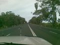
Driving between Hashes...
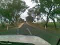
...on progressivly smaller roads.
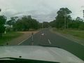
wildlife?
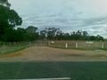
Not a road unfortunatly.
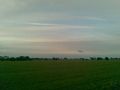
paddockage. hash off over there somewhere.

Proofs.

success, but paddocks are boring.


