2009-07-27 49 1
| Mon 27 Jul 2009 in 49,1: 49.9943346, 1.4974004 geohashing.info google osm bing/os kml crox |
Today was Juja's 1st hashiversary. Of course I was going for the hashiversary achievement, but this was not so simple. J. was in the mood to travel just now and as the chaos at work was growing, I agreed to go on holiday before nobody would let me any more. So we decided to head west, to France. We didn't know whether there would be some kind of internet access (since we slept on camping sites most of the time, electricity being quite rare in our cosy tent). So I had an agreement with Manu - she would tell me the coordinates for that day by mobile phone, and I would provide coordinates for her holiday later that summer.
It worked out very well - almost as soon as the coordinates were published on the Friday before I got them (I wasn't even thinking of them at that time). So I saved the weekend's coordinates to my Edgie (thanks Manu and Reinhard for also providing the rest of them!), but unfortunately the other two were too far away and/or in the middle of the Channel. All the better, the Monday point lay actually on our way west/southwards, so we only had to make a little detour by car.
Although I did not have any detailed map data on my Edgie for France, the basemap told me the point was near Incheville, and that information combined with the car navigation system and my personal paper map collection brought us about 1 km near the point. So we parked the car at the entrance of a nice way in the forest and entertained the thought of having a nice little walk, taking our photos and going somewhere warm and dry (yes, it was starting to rain just then).
Two things seem to be typical for the Normandy: cows and rain. We had both. We started our walk to the forest - 500m heading straight towards the point, but then the way took a turn and was now heading in the wrong direction. Well, this kind of Geohashing was an adventure for me, since we were doing it all like we were blind, not having seen the satellite picture but only having the point on my Edgie, always at least at 300m distance, at different directions. Would have saved us a world of trouble had we known it was on the field ouside the forest... but as it was, we tried to pass the forest. It was all full of thicket, and since we started in good weather in the morning, we only wore sandals, so we scraped our feet and legs and all and finally gave up that way, looking for another.
We found a real path that seemed to go in the right direction, not much more than 20cm wide but apparently a path and leading us up to 150m to the point. Then there was thicket again - damn! So we decided to try the meadow we could see at the near edge of the forest - and man, the French seem to like barbed wire to mark the edge of their meadows! After we passed that without hurting ourselves, we walked over the meadow - barefoot now, because all was absolutely wet. After we had successfully passed some dozens of snails (a delicacy in France!) and thistles, we were finally only 20m away from the point. Quite nice, might have passed, but I decided to take a photo directly on the cow field where the point was.
The cows were some hundred meters away and watched me rather bored while I was taking my picture of the GPS. Then I returned outside the barbed wire fence and we took some more pictures - that was when the cows freaked out, suddenly the air was full of Moo and they were all running towards us. We both jumped a step back and finally took to our heels when the whole herd was right before us, Mooing. The way back to the car was more easy to find but equally muddy, so we tried to get rid of the dirt and then declared the hashiversary for achieved. Away from that spooky place!
- Photo Gallery
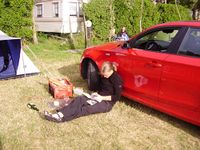
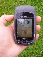
Saving the coords, already on Friday.
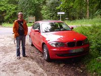
Where we parked the car and it started to rain.
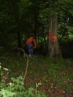
Entering the deep, dark forest.
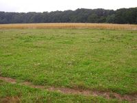
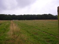
The (boring) point. A meadow in the rain.
At this time, the cows were quite some way away.
So this photo was taken directly on the meadow where the cows were standing and mooing some seconds after.
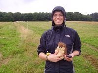
Juja, Tux and Karl - back again outside the completely safe 2mm barbed wire fence.
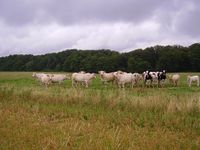
Hostile cows in the rain - that's Normandy. Frightening, somehow.
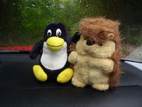
Karl and Tux back in the warm car, recovering from the wet adventure.


Awards
Paintedhell earned the Graticule Unlocked Achievement
|
Paintedhell earned the 1st Hashiversary achievement
|