2009-09-06 49 9
| Sun 6 Sep 2009 in Würzburg: 49.8835241, 9.8030964 geohashing.info google osm bing/os kml crox |
Location
Today's location is in the corner of a field near Zellingen.
Country: Germany; state: Bayern (Bavaria, EU:DE:BY); administrative region: Unterfranken; district: Main-Spessart
Expedition
srs0, Danatar
Srs0 and Danatar were planning to meet on the Main cycle path, under the Brücke der deutschen Einheit (German Unity bridge). When Danatar crossed the bridge and was about to use the path going under it, he saw a sign: "cycle path blocked". He stopped his bike and proceeded on foot in search for srs0. In the middle of the path in front of him a cat was lying. When Danatar approached it, it stood up and quickly came to him to be petted. Danatar then found srs0 and they saw that people were using the cycle path. Danatar went to fetch his bike and the rode along the Main to Zellingen. Danatar used the time to make srs0 learn some German. There they used the GPS to navigate through side streets and soon they reached the hashpoint.
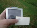
It was in the corner of a field with probably young corn, about 4-5 metres from two edges. They decided "near enough". Just after taking a picture of the GPS, when they both were putting on their stupid grinsTM for another pictures, Danatar's camera died, but srs0 had one with him, too. They soon started back the way they had come.
Danatar cycled 20.8 + 20.9 = 41.7 km
GPS

Grins

Very confiding cat wants to be petted


