2009-09-15 52 13
| Tue 15 Sep 2009 in 52,13: 52.4057106, 13.1249051 geohashing.info google osm bing/os kml crox |
Location
On a landfill site next to a golf course in Wannsee.
Participants
Plans
S-bahn to Wannsee (zone B) or Griebnitzsee (zone C) and a 5 or 3km walk respectively.
Name a time if you're going!
- Just decided to meet at S Wannsee at 4pm :) Anyone else joining? -HiroProtagonist 11:34, 15 September 2009 (UTC)
Expedition
The coordinates looked reachable and interesting, so we set off on our mission. From the satellite image it was hard to tell what the location would be: it was near a golf course but not on it, and had too many strange roads across it to be a normal park or heath.
Hiro was cycling from home, and we had resolved to meet at Wannsee S-bahn station at 16:00 but, as usual at the moment, the Berlin transport system had other plans. The service was entirely cancelled along a large stretch, so davidc didn't arrive by train until 16:40. Cycling towards the hash, Romano and Malena called from a car and we met them halfway, programmed the coordinates into Romano's iPhone and met later by the forest edge.
The first suspicions arose when reaching what should have been the edge of a large field. A gate invited us to kindly close it behind us to keep wild boar out, but the gate itself was padlocked, so we walked around the edge hoping to find a way through the fence without climbing. Further suspicions came with the discovery of many electrical junction boxes and gas vents in the middle of the forest.
Joining a small unmarked road, we found a crudely constructed stile over the fence. A sign on the gate said something along the lines of "please don't go in", but didn't actually forbid entry. So over we went, assaulted a bluff, checked the GPS, and realised we had to head back down. The ground was quite treacherous and filled with potholes. At this point we still didn't know what the area was, so the potholed ground, a seemingly pointless sewarage system, lifeguard-style observation chair, and an absolutely enormous satellite dish led davidc to confidently declare that there was a secret underground military installation.
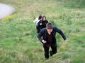
With a little cajoling, Malena was persuaded to descend the bluff again and coordinates were reached. A small sapling was given the honour of being the hash-tree of the day and Hiro picked up some GeoTrash.
By the exit of the site was what looked to be the entrance of an underground bunker. This was all the proof davidc needed to decide it was a secret nuclear missile base, hidden in plain sight. An investigation of the nearby portacabin revealed a calendar dated 1990, and yet more gas piping.
Suddenly everything clicked. With the exception of the giant satellite dish, all evidence pointed towards a landfill site with some kind of gas reclamation system. The sign and later investigation confirmed this thesis. So Hiro wins the honour of probably being the first person to perform a GeoTrash in reverse by taking trash from its final destination and putting it back into a wheely bin!
Photos
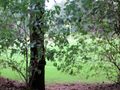
Entrance to the forest
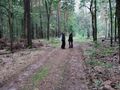
Forest path
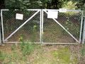
The first hurdle. "Please shut this gate behind you"... but a padlock.
"I can feel the hash!"
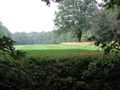
The adjacent golf course
behind a fence.
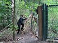
A convenient stile grants access.
The sign reads something like "Please don't come in". Not forbidden, just asking nicely.
Up the bluff to the hashpoint?
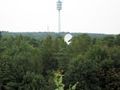
Why exactly does a golf course needs such a huge satellite dish?
Back down the bluff to the hashpoint?
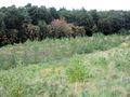
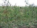
Hash "field"
Slowpokes
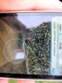
Coordinates reached!

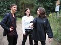
Two fresh silly grin recruits.
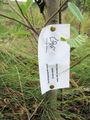
Hash sapling.

The reverse geotrash begins.
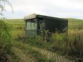
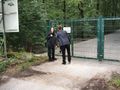
An office portacabin by the entrance.
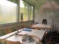
Contents: Book, coffee cup, first aid kit, gas pipe, and a calendar dated 1990.
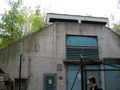
The mysterious bunker.
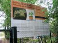
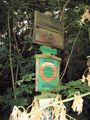
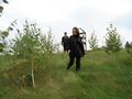
About the landfill and plantation.
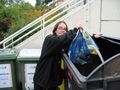
Reverse geotrash completed!


Ribbons
HiroProtagonist earned the Reverse GeoTrash Achievement
|