2010-02-06 48 7
| Sat 6 Feb 2010 in 48,7: 48.6074741, 7.9902612 geohashing.info google osm bing/os kml crox |
Location
In a field 3 km from Renchen, which is right at the western border of 48 8.
Participants
Plans
Go there by train. I'll probably have to leave the hashpoint before the 16:00 meetup time.
Expedition
While I waited at Heidelberg station for my train to Karlsruhe at the southernmost track, I took some pictures for a (very distant) future Revisited entry - construction work for a whole new city district, Bahnstadt, has already started and will drastically change the southern part of the station in a few years.
When the train arrived, there were floods of loud, drunk and wannapuncheminthefaceingly annoying people walking stumbling out of the coaches, watched over by about a dozen policemen in full anti-riot body armor. It wasn't hard to identify them as fans of Hannover 96 (a German football/soccer club). When I finally entered the train, the inside looked like a tornado had swept through it. There were half empty and even more emptied cans and bottles of beer and whiskey littered around. One last guy walked out, ripping off and stealing some hook and loop fastened pillows from the seats before he left the train. It was 12:14. The train had left Hannover at 8:00. It was three more hours until the game started (they lost, which, although I'm not interested in football much, satisfied me after I had seen what Hannover's fans behave like), and I wonder in what state they arrived at the stadium if they managed to maintain their rate of alcohol input.
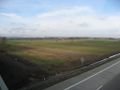
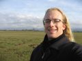
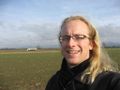
I used the 1.5 h ride to Renchen to finally start reading a book, and the time went by in a flash. When I wanted to activate my GPS at Renchen station, I realized I forgot to switch it to the "OFF" position after charging it the day before, so it was completely out of power. Not good. I had no satellite pictures with me and my Google Maps printout covered only about 10% of the existing field tracks, so I quickly lost orientation; but the knowledge that I had to find the autobahn directed me towards the sound of cars, and I soon (after a detour of only 1.5 km) found a bridge to cross the A5. After that, I only had to find the right field to step into and take a stupid grin picture. Without satellite pictures and with only a very vague image saved in my mind ("between two fields"), I simply stepped into all of the fields and took multiple stupid grin pictures at multiple field edges, just to be sure.
Tracklog
∅
Photos
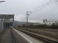
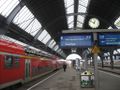
Heidelberg station, track 10
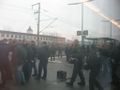
What they left (the picture can't show the smell)
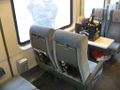
Killing time
Karlsruhe station
In Renchen
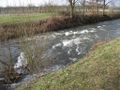
Google Maps doesn't know that river (it's the Rench)
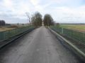
Crossing the autobahn
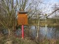
It's down there
Wrong field
Right field
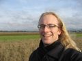
Wrong field
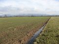
The hashpoint, looking east
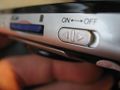
Note to self: Don't leave it in that position over night!


