2010-04-23 41 -73
| Fri 23 Apr 2010 in Danbury, Connecticut: 41.8186424, -73.5508839 geohashing.info google osm bing/os kml crox |
Contents
[hide]Participants
- Deep Horizons,
- Jay, and
- Tim.
Plans
I wanted to try out geohashing with some friends since it was April vacation. And since people are doing stuff on Saturday, we decided to do it on Friday. If the hash is in some strange area, or a place not suitable for "Hanging out", we will attempt to reach the point, then go somewhere nearby more reasonable. Games will be brought and food will be served.
Expedition
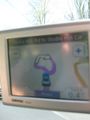
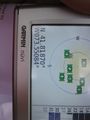
We all met up at the high school at around 12:15. We then went and got some gas, and went shopping for food., from there? OFF TO THE GEOHASH!!! Driving down the highway, off on to some main road blasting music by a radio transmitter made by me. our coordinates were off in the woods off some road in Amenia. Sadly, they must have updated the roads, and since I haven't updated my GPS's maps in a few years, it started freaking out, taking us through random roads. It even put us in an infinite loop on a road (refer to photos). But we go there.
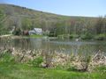
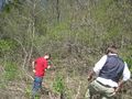
When we got near, we looked for a place to park. We found a construction management place nearby (with some friendly people who let up park there, thank god). Despite this, when we told them what we were doing, they warned us of bears and coyotes that lurk in the woods. We heeded the warning, but still proceed to the point. We walked up someone's driveway, and through the side of their yard (they had a nice barn, by the way). up a ATV trail, and then we faced our first problem. As we were walking, the trail became perpendicular to the line of travel to the hash. So we had to trek through the pricker bushes, blush, and other various nature hurdles. It was all up-hill too. Thankfully the land became flat, and we continued. We saw some nice scenery, and some cool stone walls. About 1000 feet later, we arrived at the hash point! We took in this glorious moment, took some photographs, and headed back.
Come to find out, the ATV trail lead right to the hash point, so we took that back to the road, then back to the car. From there, we went to a local park named Amenia park. We parked, popped open the trunk and pulled out the grill. We continued to whip out all the stuff we bought from shopping, and cooked hot dogs. After we ate, we packed up, and started to head home. I set the GPS to the "scenic" setting, making the way back home longer, but much more enjoyable. We made our way out of Amenia, through Kent, through New Milford, and eventually made our way back home.
A very good day indeed.
Gallery
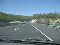
Driving up to the hash

Amusing
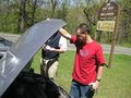
fixing the car

Haha
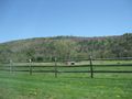
A beautiful sidescape
Yea, had some fun there
Just a pic of
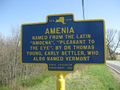
Entering the town
Some more trouble...

YEA, Finally there
And just to show
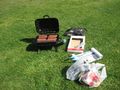
THE BEST PART!
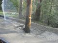
And a pole in the middle of the road


Achievements
Deep Horizons, Jay, and Tim earned the Land geohash achievement
|
Tim earned the Formal attire achievement
|
Deep Horizons earned the Drag-along achievement
|