2010-07-01 48 8
| Thu 1 Jul 2010 in 48,8: 48.1264053, 8.6430719 geohashing.info google osm bing/os kml crox |
Location
In a mining pit at Deißlingen-Lauffen. It's not a field any more.
Participants
Expedition
The longer the consecutive run, the longer the stupidity distance. Seriously, I was about to give up - not for inaccessibility, but mostly because being on a daytrip each day, several days in a row, starts to take its toll after some time. You know, geohashing isn't the only thing in life. Just for an example, I was about to run out of clean clothes, but there simply wasn't any time left for doing laundry.
However, 7 would be a nice number. And who knows what comes next - I definitely knew: If I would skip this one and the next one gets easier, I would be angry about myself. If you don't go everywhere by car and spend hundreds of Euros for gas and maintenance, but use bike, public transport and your own feet, a chance for a significant long consecutive run is really rare. And here it was. Or at least: Seemed to be.
Cheapest way to get to the hash would have been to take a train to Balingen and from there the bus to Rottweil, via Endingen. Sounds familiar? Then you've probably read the other reports as well. Yes, that one would just pass through 2010-06-29 48 8. However, I didn't really want to take the same direction three days in a row, so I took the train to Rottweil instead for both being faster and offering more flexibility. At Rottweil I changed to a train to Deißlingen, where a bus went to Lauffen, shortening the hike to the hash.
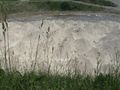
Got off at Lauffen and soon realized I should have planned out the route a little bit better. Hit dead end roads several times, but finally found a way out of the village on the side of the hash. Walked out along a paved track, and then into the field the hash was supposed to be in.
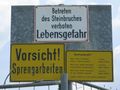
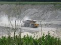
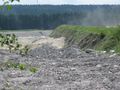
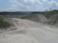
Only that it wasn't. What had been a field on all maps and aerial pictures I had found, now was a mining pit. The pit, or excavation area, was there before - it just had been significantly enlarged and now included the hashpoint. 15 m was as close as I got, 15 m horizontally and too many vertically. Also, this is an active mining pit, so breaking in there was definitely not an option, and - mostly for safety and insurance reasons - the chance to be let in if asking an employee is a clear zero. So I had to file this hash as a failure - No trespassing.
With that, the consecutive chain was broken. And it wasn't really my fault.
For getting away from the hash I made a bad decision, being that I tried to get to another village and look for a bus or train there. Problem was, that the way which seemed to lead into the right direction, didn't go through, and neither allowed to continue off road. There simply was no way to cross the railway main line somehow safe, whether at a legal or illegal place. Turned back, hit the same problem with a deep cutting which was all too steep. Went further back, hit a dead end, but this time terrain and civilization weren't in the way to just continue through the forest. And finally, I reached some industrial area out of Rottweil, where a city bus came along soon enough.
Gallery
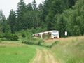
A train like this one brought me to...
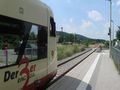
... Deißlingen station
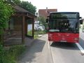
Bus stop at Lauffen - get off here
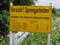
First sign of trouble - however, I didn't want to go into the mine, did I?
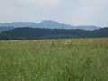
Looking over the field towards the hash
Second sign of trouble - uh, this was not supposed to be here.
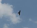
They're coming to get you!
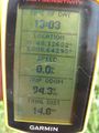
Coordinates not reachable - 15 m to go. The consecutive series ends here.
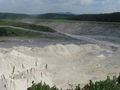
The hash is somewhere down there
In these heaps, probably
Another view on hash
Here it would go in, but not for me
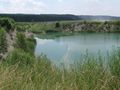
An older part now flooded
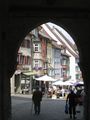
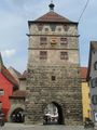
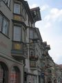
At Rottweil
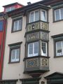
Most houses along the main streets of the old city centre of Rottweil have such painted bay windows


Consecutive geohash
This hash was the last of a series of 7 consecutive geohash tries. However, since I didn't reach the coordinates, they only count for 6 for the achievement.
- 2010-06-25 48 9 - Reutlingen-Mittelstadt, by bike
- 2010-06-26 48 9 - Riederich, midnight hash by bike
- 2010-06-27 48 9 - Langenenslingen, by train, bus and bike
- 2010-06-28 48 8 - Rottenburg-Ergenzingen, by bike
- 2010-06-29 48 8 - Balingen-Endingen, by train and bus
- 2010-06-30 47 9 - Sauldorf, by train, bus and hiking
- 2010-07-01 48 8 - Deißlingen-Lauffen, by train, bus and hiking - No trespassing
Ekorren earned the Consecutive geohash achievement
|