2010-10-12 52 0

| Tue 12 Oct 2010 in Cambridge, UK: 52.3394890, 0.2937177 geohashing.info google osm bing/os kml crox |
Location
In a field in the Fens, about 3 km west of Soham, Cambridgeshire.
Participants
Plans
This one was fairly close to Cambridge -- only 16.5 km in a straight line from my house -- and was just inside the corner of a field, so looked like it would be very much accessible. The problem, as it turned out, was getting to it.
I looked at the coordinates in the morning and tried to work out how to get there. It seemed near enough to cycle, but Google at first tried to suggest a 33 km route -- double the straight-line distance. That seemed a tad excessive. Playing around with Google gave me a few options -- a 26 km road route up the busy A10, a 30 km road route along quieter village roads, or I could go up the River Cam, which would be only about 23 km, but probably unsuitable for cycling. I didn't like any of these options much, and since it was already late morning, I elected to drive to the hashpoint. I made lunch.
While eating my toasted sandwich, I found my Ordnance Survey map of the area (they show everything and are ideal for planning cycle routes). Some careful tweaking of the route in Google with a close study of the bridleways and footpaths on the OS map brought the cycling distance down to about 21 km. This seemed achievable without taking too much time out of my day. I am, after all, supposed to be on study leave for exams this week. Ok then, cycling is back on.
Expedition
To be written tomorrow.
Photos
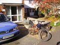
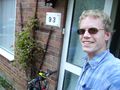
Everything ready? Let's go!
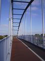
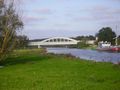
Cycle bridge between Cambridge and Milton ...
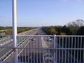
... over the busy A14.
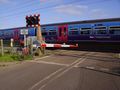
Level crossing over a very small road.
Miles and miles of head wind ...
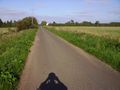
... and then I turn off it onto this!
Turn left at the river.
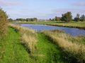
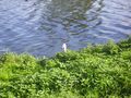
The river bank is a nature reserve.
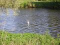
Swan coming over to investigate me.
Hello!
Finally I can leave the bumpy river path.
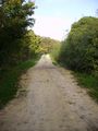
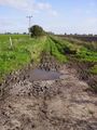
More muddy track.
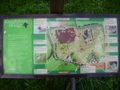
Another nature reserve.
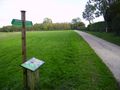
Short stretch of nice, flat road.
Almost the worst surface of the day.
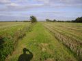
Flatness and fields as far as you can see.
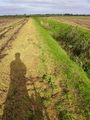
Definitely the worst surface of the day.
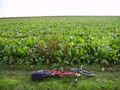
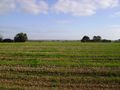
Green things. The hash is in there.
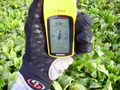
Made it; hurrah!
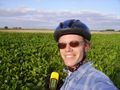
Happy hasher.
Home again. This doesn't show how tired my legs are.


Achievements
Benjw earned the Land geohash achievement
|
Benjw earned the Bicycle geohash achievement
|
Benjw earned the Consecutive geohash achievement
|