2011-01-08 45 -123
| Sat 8 Jan 2011 in 45,-123: 45.2864810, -123.6481846 geohashing.info google osm bing/os kml crox |
Location
In the coast range about 3 miles off of the road through the nearest pass, and a ways east of Beaver, Oregon. There are NFD roads which come closer, but those tend to be of very questionable accessibility this time of year.
Participants
Plans
I plan to start my drive sometime around 9AM. According to the Google, it will take about 2 hours drive time to get there. I am assuming that it will be a 3.5 mile hike or so each way, since I can't drive up the NFD roads beyond the main one crossing the pass. That should put me at the hashpoint around noon or so. I will need to take the OR-6 pass to get across the coast range, because the NFD 85 pass rises above the snow level, and is unlikely to be accessible for my car.
I'd join you, except I have folks coming in to work in our server room earlier in the morning, and I'm certain we won't be done by 9AM. Have fun! Jiml 12:44, 7 January 2011 (EST)
Expedition
I awoke a slightly past 8, and started on my preparations. I had much to do, and little time to do it in, if I wanted to get done with the expedition, and back across the pass before the sun gave out. The reason for not wanting to cross the pass at night: it was snowing up there overnight last night, and will be throughout the day and overnight tonight as well. So, that means that I had to go grab some chains for my car, just in case we got more snow then expected. I proceed to enter coordinates and gather everything I will need for the expedition, and add in a shrubbery, for some SF0 tasking.
I then start drive off to get chains, and to head off to the mountains. The pass has about 0.5 inches (1cm) of snow as I drive, so I take it easy, and everything is just fine. I then continue to drive around to get to the NFD (National Forest Department) road which I will hike up to get to the point. The road starts off quite steep, and wears me out pretty quick. Man that shrubbery is heavy! The road is quickly climbing up a cliff, and offers me some great views of the creek's canyon, and some pretty spectacular rapids and water falls along the first bit. It has been misting on me for most of this, but not really heavy enough to pay much mind.
The rest of the trip, however, is done in the following kinds of precipitation: rain, snow, snow pellets, ice pellets, and just about every combination of those you can think. The hike up into the mountains was quite awesome, but also quite tiring. When I got to the nearest point to the hashpoint, I was already tired, and the way to the hashpoint was much steeper than I had anticipated, so I decided to call it a day at about 600 ft (200m) or so from the hashpoint. It was here that I did the SF0 tasking, and am glad I did it, even though lugging that darn shrubbery up a mountain was no fun.
The way down was uneventful. I stopped for gas and a meal at Tillamook on the way back, and the pass on the way back was almost completely clear.
APR reports that he's on a mountain in the Coast Range, so he's at least halfway there Jiml 15:09, 8 January 2011 (EST)
APR can now report he got as close as 0.12 miles away from the hashpoint. No more reports until APR is less tired. --aperfectring 19:56, 8 January 2011 (EST)
Tracklog
Photos
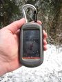
Proof of failure
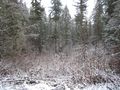
Towards the hashpoint

Me at the nearpoint
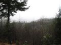
A sample of the scenery


