2011-01-16 49 8
| Sun 16 Jan 2011 in 49,8: 49.4094994, 8.8520626 geohashing.info google osm bing/os kml crox |
Contents
[hide]Location
2 km from Neckarsteinach, uphill and in a forest.
Participants
Expedition
ilpadre
This Sunday felt like the first day of spring. For the first time this year the sun shone brightly, not obscured by even a single cloud. Perfect weather for an expedition! With the hashpoint being about 20 km east of Heidelberg, and a beautiful, scenic and popular hiking/biking route leading from Heidelberg almost directly to the coordinates, I normally wouldn't have thought twice about going by bike or even trying to walk (and go back by train). But since my health was a bit of a problem during the last weeks, and I had to take antibiotics until Sunday, any kind of activity even remotely looking like sports was out of question. However, I just bought a new pair of hiking boots the day before, and figured a bit of relaxed walking through a forest on a perfectly sunny day couldn't hurt much.
Shortly after I arrived at Heidelberg main station, planning to take the 10:55 train to Neckarsteinach and walk the last 2-3 km to the coordinates, Ekorren called me and told me he intended to go to the hashpoint by bike. We agreed to travel to the hashpoint independently, and wait for the other geohasher.
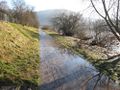
Neckarsteinach, east of Heidelberg and between mountains (it's famous for its four castles in town) was still lying in fog as my train arrived, but as I made my way uphill, the sky soon cleared. Neckarsteinach, being in a popular recreational area for many people living in the region, has a dense network of hiking paths. But it also lies in a region heavily flooded just a few days before (a man even drowned in that very town, and officials in Neckarsteinach are still searching for his body with helicopters and lots of equipment). This means that many ways were covered with mud, and I stumpled upon another problem: As I was approaching from the west, I had to get downhill, through a valley and uphill again to the hashpoint. Valleys tend to transport water downhill. And if there's currently a lot of water even at places where you don't expect it... well, let's just say I spent a lot of time trying to find a place where I could safely cross the creek running between me and the coordinates. I finally found a spot, and thanks to my new boots, I didn't even slip on the mossy stones.
I found the coordinates quickly, and realized they were right next to a hiking path. But if I had approached from the east, I would have missed the fun of crossing that creek. It's the little adventures that make expeditions memorable. I left a marker and only had to wait about 10 minutes for Ekorren, who had made the wise choice and followed the hiking trail. We both took a couple of pictures and left.
Just before I reached Heidelberg again, and shortly after Ekorren left the train one stop before the main station, I realized I had forgotten my bag with my GPS and some other stuff in it at the station in Neckarsteinach. Luckily, I had my cell phone in my jacket. Since I would have needed to wait almost an hour for the next train to Neckarsteinach, I decided to call my girlfriend, who coincidentally happened to be on her way back from a visit to her family, having just passed Sinsheim the moment I called her. She immediately left the autobahn and managed to be in Neckarsteinach about 45 minutes later, sparing me the inconvenience of waiting for the train to Nackarsteinach (55 min), getting there (20 min), waiting for the train back to Heidelberg (25 min) and getting back to Heidelberg (20 min) - a total of 2 hours! After she texted me that she found my bag, the least thing I could do was to buy her flowers at the station.
Tracklogs
- ilpadre's way to the hashpoint: http://www.everytrail.com/view_trip.php?trip_id=936803
Photos
ilpadre

A place worth revisiting many more times in the future. [Link (German)]
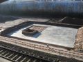
Construction already started.
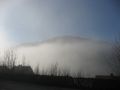
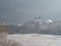
Fog in Neckarsteinach.
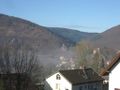
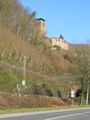
The four castles Neckarsteinach is famous for (one is behind the tree).
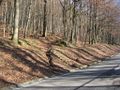
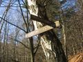
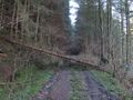
Shortcut.
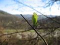
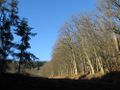
It felt like the first day of spring.
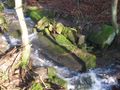
A creek between me and the hashpoint.
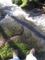
I crossed it with dry feet.

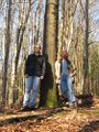
Obligatory.
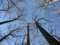
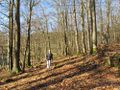
At the hashpoint, looking up.
On the way back.


Ekorren
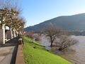
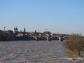
Heidelberg
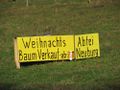
Christmas tree sales start in only 314 days!
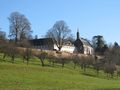
Neuburg abbey
Neckargemünd
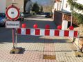
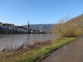
Road closed for flooding
After the flood: Still wet
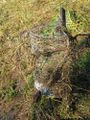
Camouflaged bin
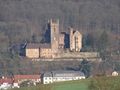
Neckarsteinach: Three of the four castles...

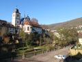
... and a church
A road less traveled
The Neckar hiking trail connects both Ilpadres and Ekorrens home with the hash.
Somewhere in there
Meetup!

Coordinates reached