2012-01-08 50 11
| Sun 8 Jan 2012 in 50,11: 50.8598338, 11.4800450 geohashing.info google osm bing/os kml crox |
Location
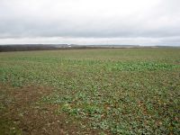
A (very) muddy field between Milda and Zimmritz.
Participants
Expedition
Today’s geohash expedition might get the headline “Three little Indians” and for 5 seconds I had the idea to write this report in rhymes, but I’m not a poet and it would probably end up like thousands of amateur wedding poems and so I discarded the idea.
We started half past eleven and our weather forecast (Wetter-Online.de) told that we will meet two raindrops on our way (maximum is three), so we knew, we might get wet on our bicycles. But it was not only the water that came down, there was a lot of air on its way in the opposite direction (of course, where else?) So it happened that after 11 kilometers the ninja accompanying us told that he will drive back. One kilometer later even Juja gave up because of the rain. And because of me I think, since I lowered her average speed by 50%, what meant even more water.
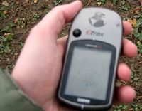
So I was the last Indian, that reached the hashpoint. Next inferno: the accu of my camera told me: “Um, sorry, I’m empty”. I said: “Hey you, that is impossible, you got one hour charging time before we started”. “Maybe, but that’s two hours ago. Now I’m empty”. (When we were back home again, the charging device switched from red to green after 5 seconds, but that’s another story). But I found a way to take at least three emergency pictures by switching the camera on and immediately pressing the button before the camera auto-switched off again, without waiting for the focus to become correct. That explains the “high quality” of the pictures. Especially the “coordinates reached” picture without focusing is let’s say “interesting”. Yes, there might be a flag within a circle. But where was it? Believe me, it was at today’s point.
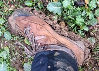
After coming back from the field, one kg heavier than before (see picture of my shoes), I decided to go back via Schirnewitz, Schöps, so that the tour had a length of 45 km when I was back home again.
Photos
|


