2012-08-15 47 -122
| Wed 15 Aug 2012 in Seattle: 47.9657004, -122.4400775 geohashing.info google osm bing/os kml crox |
Location
All the way up on Whidbey Island. Field near a tree line.
Participants
Plans
First Geohash attempt!
Going to head out around 6 from Ballard. Will take the ferry across the sound and drive out there. Should get there an hour or so before sunset!
The Ferry from Mukilteo is a lot faster/cheaper than driving up through Anacortes and down. Short walk across a field off Coyote Trail Road which may be private. Coming from the other direction looks like a walk through a forest from Sills Road.
Expedition
I didn't make it.
Planning on embarking around 6:00 and catching the 7:00 ferry, I would be able to arrive by 8:00 at the latest. This would theoretically grant me half an hour of remaining light before the sun sets behind the island tress. I knew that my journey would cause me to leave the road and needed what little help from the cosmos I could glean.
Being the novice of ferry travel that I am, this plan proved to be naive at best.
I arrived at Mukilteo as the 7:35 ferry was leaving. To make matters worse, I was so far back in the line that I ended up being a paltry 4 cars shy of being allowed onto the 8:00 ferry. This meant that I would not embark from land until darkness was already upon me. I worried as my prospects for success diminished.
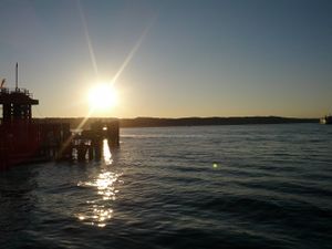
To my surprise, however, any thought of disappointment was gutted entirely as I witnessed the summer sun burst across the sky in a flurry of color and water. As it retired from a day's hard work, it left behind a view that was nothing less than intoxicating. I know that, whatever the outcome of my journey, it would all have been worth it.
It was getting dark fast as I arrived on the island and drove off toward the point. If you examine the point you will see that there are 2 entry sides. From the east, there is coming in from the end of Coyote Trail Way which goes through a field. From the west, you stop off of Sills road and trek through the woods. I went for Coyote Trail Way first, knowing full well that it would probably end up being a private lane.
There were no signs against trespassing that I could see so I drove down the narrow, winding, single-lane path into the darkness. It eventually opened up to 2 very nice houses with paved driveways. GPS put me some 800 feet from the destination. Had it been afternoon or early evening, I would have had no trouble knocking on a nearby door to gain permission (nabbing an Ambassador Achievement) to trek on what was, no doubt, one of these house's property. But this was around 9PM. I could see lights on in the living room. No doubt the children had been put to bed and the weeknight rituals of jeopardy or what-have-you were likely in full swing. These 'islanders' are foreign to me. After all, any man willing to pay upwards of $20 a day riding a boat as part of a several-hour commute must only be unstable in several key areas. I decided that it was best not to test the consequences of being the strange man snooping around the house under cover of darkness and bravely fled.
Returning to the main road, I traveled south to meet up with Sills road and attempt entry from the west. I slowed the car as my GPS showed my getting closer. 900 feet. 800 feet. 750 feet. 780 feet. Wait. I then backed the car up and disengaged on the side of the road at a distance of 744 feet (226 meters).
I had passed a few houses set against the trees off the road. I didn't want to outstay my welcome for the reasons mentioned above. Next to me was a solid wall of brush as tall as I am. It had grown to pitch dark in the trees. My options were to try and push through and then trek through the trees or else to backtrack into someone's driveway and sneak past their house.
Once again, had it been daytime, I may have attempted it. But suddenly the reality of trampling a 6th of a mile through the woods in the dark on an island far from home settled upon me and I decided to admit defeat.
In the end, I'd call it partial success. I made it to within 250 meters and got some breathtaking views out of it.
Lesson learned: Do not attempt a hash far from civilization unless you know you can reach it before dusk. This restricts hashing outside the city to weekends only. Which I'm ok with. This was a great first experiment and I'm excited to try again!
Tracklog
Check out my Instamapper Tracklog here.
Photos
Achievements
p4r4digm earned the Prize poultry Consolation Prize
|


