2012-09-12 51 -0
| Wed 12 Sep 2012 in London West: 51.4066561, -0.1910491 geohashing.info google osm bing/os kml crox |
Location
Today's location is in a park on the southern end of the London area.
Planning
A hash on public property, and accessible by tube? I can't pass this one up! Due to time constraints, I'll likely head over around noon. -Haberdasher 12:36, 11 September 2012 (EDT)
Participants
Expedition
I attempted to drag one of my friends along to what I dubbed my "morning adventure", but those that were up had other plans or were not interested. Thus, a few minutes before 11, I headed out on my own.
I had learned the night before that the Northern tube line was a bit of a mess, and Google Maps kept trying to get me to take buses rather than the tube to Morden... I discovered that this was because the line I was on did not go straight to Morden, but ended at Kennington. However, catching the correct route from there was no difficult thing, and I was on my way.
I had been a bit afraid of going on my own to Morden, as I'd heard that South London could be sketchy, but I had no trouble in Morden, save figuring out the awkwardly-placed traffic signs and reconciling them with what my written directions and my GPS told me. But, with a bit of patience and trial-and-error, I found Morden Hall Park quickly enough.
Morden Hall Park was quite a different place than Morden proper- two steps in and I felt like I was in the country. A wonderful place to geohash, except that my GPS couldn't find satellites. I found a bench a ways down, in the direction which I remembered the hashpoint being, and waited for it to find where I was... and waited... and waited... After 20-30 minutes of waiting, my GPS was still no closer to knowing where I was, and I was afraid of being late to class, so I had to leave. It literally took the GPS less time to determine that I'd gone from Chicago to London than it took it to (not) determine that I'd gone from London to Morden.
I checked the path I'd taken on Google Maps afterwards on the off-chance that I'd passed the hashpoint in my wanderings, but I was a good 300 feet or so off- though, like my ill-fated Fermilab hash, it would have been easy enough if the GPS had cooperated. Not even a new and exciting way to not reach the hashpoint this time.
Pictures
Apparently most of the photos my camera takes are too big to be uploaded to the server. Some have been cropped, others left out.
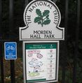
Morden Hall Park
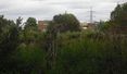
Not quite country
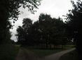
Two paths
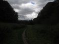
Side path in the park

Bench (and log)
Locating...


Achievements
Haberdasher earned the Blinded by Science Consolation Prize
|