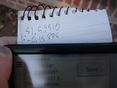
2012-11-18 51 -0
| Sun 18 Nov 2012 in London West: 51.5951047, -0.1588610 geohashing.info google osm bing/os kml crox |
Contents
[hide]Location
Today's location is where a front yard meets a forest in Muswell Hill.
Planning
- Heading by sometime on Sunday. -Haberdasher 10:23, 16 November 2012 (EST)
Participants
Expedition
This looked like an easy enough hash. Get on the Northern line, go to East Finchley, then the hashpoint's just a short walk away.
The first obstacle I encountered was, upon reaching the nearest Northern line station to me, the discovery that the Northern line's planned closures meant that there were no trains to East Finchley today. Luckily, the Underground worker who informed me of this also told me of a bus line which would take me to the same area. However, he didn't tell me which stop would be closest, so after compulsively checking my GPS as we got nearer, I ended up getting off several blocks before the actual closest stop.
Because of the different approach to the area from the bus stop as opposed to the tube station, I ended up seeing more of Muswell Hill than I would've seen otherwise. Sunday mass was apparently just getting out as I arrived, so the town square was bustling. I saw a group collecting food for International Mitzvah Day, which made me smile. All in all, the town had the feel of a small country village, though the occasional buses and view of the city indicated otherwise.
Upon reaching the approximate area of the hashpoint, I encountered a second obstacle: my GPS became even worse about updating its position than usual. As in, it would claim it was in the same spot for several minutes at a time before updating, all the while claiming that it had maximum navigational accuracy. With my GPS largely useless for geohashing, it was time for a little detective work.
At first, I thought it was near the entrance to the woods which was adjacent to one of the houses (and wandered around near the park entrance to hit the hashpoint if it was there), but the few updates I was getting from my GPS seemed to indicate that it was further west than that. Looking more closely at what my GPS had displayed, the point was roughly at the halfway point between where two side streets branched off, and I quite clearly remembered greenery showing up on the hashpoint in Google Maps, so only two houses' greenery displays seemed like possible locations. I circled each of the two suspects for the hashpoint location as thoroughly as I could without fence-hopping or otherwise seeming unduly suspicious to the intermittent passersby, then headed back home. Before taking the bus back, however, I stopped at a gelato shop in the town square, got some lemon sorbet, and watched the world go by for a few minutes. Managed to get a Christmas present for my little cousin on the way back too.
Upon getting back to my flat, I examined the Google Maps display of the hashpoint's location, specifically using Street View, and found... that it was, in fact, near the entrance to the woods, just as I'd originally thought. I suppose I shouldn't be surprised that my GPS was being inaccurate as well as refusing to update. Still, I definitely wandered around the area where the hashpoint is enough to call this one reached.
Pictures

Church
GPS

Stupid Grin


