2013-06-20 62 25
| Thu 20 Jun 2013 in 62,25: 62.2341834, 25.0732539 geohashing.info google osm bing/os kml crox |
Location
In Petäjävesi. The point lies in a swamp
Participants
Expedition
Our trip continued from the previous hashpoint.
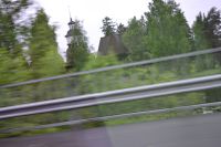
We drove past Jyväskylä, and continued towards Keuruu. It was occasionally raining. On the way we passed Petäjävesi Old Church, which is present in the Unesco World Heritage list. As usual, my sightseeing on it consisted of looking it from the window of a car wooshing by 80 km/h. This time I even managed to take a picture. I've actually never visited the church, although I've driven past it dozens of times. Always quite in a hurry at this point somehow. Shame on me.
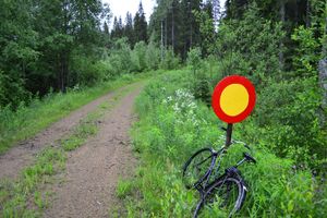
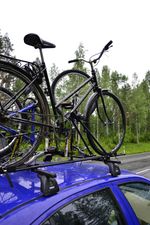
After passing the Petäjävesi municipality center we were already quite close to the hashpoint. The baby was becoming restless, thus it was a good time to make another rest stop! I had marked the intersection to the small road this time also. Now the intersection was even smaller than previous time, and I could not locate it in time to actually turn to it. Luckily there was a bus stop 50 meters from the intersection, and I stopped on that. While passing the hashroad intersection I saw that there was a traffic sign forbidding driving by any vehicle! Oh no! But if you looked carefully the pictures in the report of the previous hashpoint, you may have already noticed that I had one ace in my sleeve. In the roof rack of our car I was carrying two old bicycles to Keuruu to be put in some retirement duty there. One of them was more easy to detach from the roof rack, so I took that. Luckily in the morning before we left I had fixed the flat tyre on it.
I left the baby to receive some fresh snack from her mother and rode my bike towards the hashroad. The sign in the beginning of the road technically forbids all vehicular traffic, and also concerns bicycles. However, it is not legal to forbid the moving of muscle-powered vehicles on private roads like this. Therefore I chose to ignore the sign and continued on my bike whose gear-changing mechanism was broken and had been wedged to the first gear. There was only 700 meters to the hashpoint. (Someone may notice at this point, that it would not have been necessary to use the bike at all, but it made a good storyline, didn't it? Also it was faster and easier. And I got a bicycle achievement.)
After few hundred meters the arrow started to veer to the side. In about 330 meters the distance stopped decreasing. Time to leave the bike and continue on foot. There was a little widening on the road and a large, shallow depressing in the ground. Probably some ancient building had been there, but it had probably been made of wood as now there was nothing else to be seen but the depression.
I entered the forest. A few dozens of meters was easy going, but then the actual swamp started. That meant a little soft footing and some hummocks which hindered going. There was also the ditches dug there to make the swamp a little dryer. But dry it was not. Although it wasn't raining, there definitely had rained a lot before. The swamp-forest was soaking. In the previous hashvisit I had thought my jeans were wet, but it was nothing. Now they were really drenched. But it's summer, so no matter. Wait, it's only 12 °C. Well, can't do anything about it, so no matter.
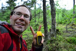
Nearing the hashpoint I encountered some thick spruce walls, and then the forest opened up again, as I crossed a small hill. Only 50 meters to go! The hashpoint was in a quite open area, luckily not in the thickets. As I set up my photographs, a horde of mosquitoes was buzzing around me. An interesting fact is, that I now has photographic evidence how long it takes for the mosquitoes to land on a skin of a person standing still in forest. The time is about one minute. My self-portrait above is the fifth picture I took at the hashpoint, and there are two mosquitoes standing on my forehead. At the fourth picture there are not yet mosquitoes.
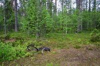
With the pictures taken and not wanting to spend a lot more time with the mosquitoes, I turned back. When I had started towards the hashpoint, I had noticed the poor visibility in the swamp, and marked the location of my bike to the GPS. This was relieving, as the thickets had made my way to the hashpoint quite curvy and I was not exactly sure of the right direction. With the help of GPS, I headed steadily back to the bike, and then rode back to the car. A nice hashing trip, despite the wet feeling in my trousers.
Additional driving distance by car to visit the hashpoint: 0 km. Biking distance: 1,2 km. Walking distance: 0,5 km.
Additional photos
Achievements
Tilley earned the Multihash Achievement
|
Tilley earned the Bicycle geohash achievement
|
Land geohash.
