2013-06-20 62 26
| Thu 20 Jun 2013 in 62,26: 62.2341834, 26.0732539 geohashing.info google osm bing/os kml crox |
Location
In Pönttövuori, Jyväskylä. The point lies in forest.
Participants
Plans
We were traveling to my parents-in-law for the midsummer weekend. The evening before I noted to my delight, that two hashpoints fell almost directly on our way! On the first one the detour was less than 2 km and on the second one less than 1 km. Too good an opportunity to miss! Just has to hope our resting stops align themselves with hashpoints.
Expedition
We left home at noon. The infamous Sleeping Baby of course fell asleep, and our first stop was planned to be at the hashpoint. Our journey went well among the traffic that was more numerous than usually - other people also wanted to be at some other place for the midsummer. As we approached the hash-area, it started raining lightly. I had marked the right intersection to GPS, which was good, as the intersection to a gravel road was really small, and I didn't want to make any sudden moves among the traffic.
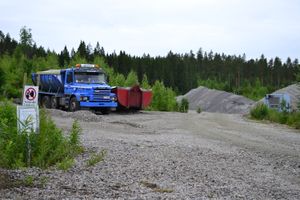
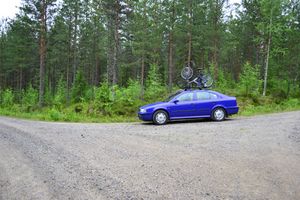
After turning to the small gravel road there was 1,7 km to the hashpoint. The road was passable, but it had a lot of big holes which I had to dodge. After some bends there suddenly was a gravel quarry, which had signs forbidding entrance. For a second I thought we could not pass, but before the sign the road turned sharply and went around the quarry. We continued, and shortly went over the railroad tunnel going under Pönttövuori. It couldn't be detected from the surface, of course. After few hundred meters we were at an intersection, which I had previously scouted from the map to be the place to leave the car. And that was correct: the arrow was pointing straight into the woods. Some 200 meters to go.
I parked the car and the baby awakened. Perfect timing! She then was released from her crib, and was served some snack. During that I prepared for the hash-visit. It was still raining and the forest was definitely wet. I changed to hiking boots and put on a gore-tex coat. I was going to pay a quick visit to the hashpoint while the baby was finishing her meal and preparing for potty-business.
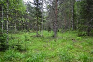
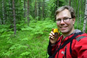
I crossed the ditch and entered the forest. The undergrowth was wet alright. My jeans' bottoms were quickly becoming wet. The forest was nice to walk in, though. Not thickety, but actually quite open. It was even resembling pasture in some places with tall grass and only a few trees. I noticed that GPS reception was not as good as usual, probably due to thick layer of clouds. The direction arrow was updating quite slowly, and I was walking a curvy path. After a while I nevertheless found the point, or did I? I had to GPS dance for a minute or so to get the reading to show less than 5 meters, that was very unusual for the eTrex. Then finally I got a reading of 2,39 meters, which had to suffice today. I definitely was there. And what a place it was! The rain was beginning to cease, and the forest was very green and fresh. There were some soft-looking ferns covering the immediate area around the hashpoint. A nice day to be hashing!
I then left the site and walked back to the car, this time a more straight line. I wonder why the GPS hadn't shown this direction right from the start? In the car there was a treasure waiting in the potty for the dad to take care of, which I did. We then packed our caravan back to the traveling-mode and left for the next hashpoint.
Additional driving distance to visit the hashpoint: 3 km. Walking distance: 0,5 km.
Additional photos
Achievements
Land geohash.


