2013-09-28 44 1
| Sat 28 Sep 2013 in 44,1: 44.5975143, 1.5359618 geohashing.info google osm bing/os kml crox |
Location
In a field near Saint-Martin-de-Vers, France.
Participants
- Pastori
- The Wife
Expedition
(Pastori's European tour begins here.)
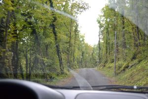
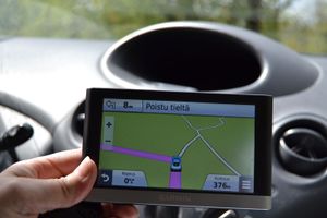
Our quest continued still further south. The hashpoint in southern France seemed to be quite close to our route, so we typed in the coordinates to our car satnav. It routed us through some really strange small roads, where we sometimes wondered if they are really drivable. The Wife got lost of our position in our paper map, so we had no other options but to continue. Eventually the hashpoint popped right to the side of the road, into a field, only 8 meters from the road. The scenery was calm and relaxed with some leaf-tree forests. Pastori and The Wife were happy with their accomplishment. To find their way back to the bigger roads was another thing and required some extra curves.
Our journey went on towards Andorra. There, in the graticule 42, 1, the point happened to lie today in the territory of Andorra, but the monstrous serpentine roads in the mountains, at highest point 2400 m from sea level, confused Pastori and The Wife so badly that they just desperately drove to their place of stay, and barely were able to stretch themselves into their beds. The total distance from our home to Andorra was 3733 km. Now we fortunately have a whole week to rest in the same place.
[Editor's note: Due to this trip they have probably forgot, but this is Pastori's and The Wife's six-months-hashiversary. They began their geohashing career exactly half a year ago with this expedition.]
Our tour continues here.
Achievements
Pastori and The Wife earned the Graticule Unlocked Achievement
|
Pastori and The Wife earned the Land geohash achievement
|


