2015-08-02 51 13
| Sun 2 Aug 2015 in Dresden: 51.0012012, 13.7057050 geohashing.info google osm bing/os kml crox |
Location
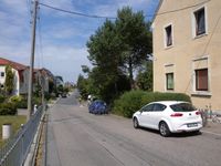
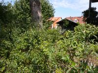
Today's location is at the (h)edge of a garden in Bannewitz-Cunnersdorf, a town next to Dresden.
Country: Germany; state: Sachsen (Saxony, EU:DE:SN); district: Sächsische Schweiz-Osterzgebirge
Weather: sunny with clouds, about 25°C (no local measurement)
Danatar
Planning
This hashpoint is not far and the weather should be good. I plan to cycle there somewhen during the day, I don't have a time planned yet. From the satellite image the spot should be within 2 m from the fence, so I hope for the GPS inaccuracy to bring the exact coordinates to me.
Expedition
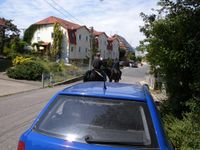
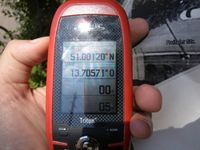
The plan more or less worked, although it was not as easy as I thought. I started at quarter to noon and cycled through the Großer Garten and along the streets of southern Dresden until I reached the city limit. There a dirt track crossed under the Autobahn and went past fields. The track went uphill, which was tiring, but I finally reached Cunnersdorf. There I had to climb another slope to the hashpoint area. Sweaty I stopped the bike next to a parked car at the hedge that grew around the garden and waited for the correct GPS coordinates to show up. Most of the time I was a little too far to the south of the spot, with 2-5 meters to go. Walking to the nearest street corner and back to move the GPS unit around didn't help. After about 10 - 15 minutes a guy living on the other side of the street came out of his house and asked me if I was ok, so I told him about this "adventure game" with random places that wanted me to come here. He was friendly and amused. Shortly after another neighbor came by and the guy told him about the funny thing I was doing here, to which the second guy wished me good luck before continuing. The first guy asked me if I wasn't maybe near enough already to which I replied that I wanted to get the exact coordinates because the spot would be on private property otherwise and would not count in my opinion. He proposed that I could go into the driveway to the next property over, because it counted as a public path (it had a gate so I didn't do it), or that I could ask the people living in the house.
As another few minutes of waiting didn't help the coordinates reach me I did just that. The first two bells weren't answered, the third one (I had heard children shouting from that direction the whole time) was and I climbed the stairs to the first upper floor. A girl opened and I asked for her parents, a woman of about 35 (she had arrived some minutes earlier by car and I had moved my bike after she scowled at me because she apparently wanted to park just there) and an older woman came. Again I started with my story about an adventure game, which the still scowling woman interrupted, saying she had an adventure game all day because of the kids. To my question if I could go into their garden for a picture she replied that she wasn't authorized to let strangers in the garden. I thanked them for their time and left, accepting defeat and another "no trespassing". But when I left the front door the GPS showed a LAT position considerably north of the hashpoint, so I quickly went to the part of the hedge with the correct LON offset. And HOORAY, I was there! The neighbor, still amused, went inside at that moment because his pizza was ready. Relieved I took my bike and started back to Dresden. The steep part of the journey was the easiest now and I reached 50 km/h going downhill.
With this expedition I finally reach a regional geohash greater than two. It took me almost 7 years, although for this district it was only 11 months.
Danatar earned the Regional geohashing achievement
|
|


