2016-02-05 50 7
| Fri 5 Feb 2016 in Bonn: 50.8284982, 7.2889059 geohashing.info google osm bing/os kml crox |
Contents
[hide]Location
A wet meadow south of Seelscheid, in Schreck.
Participants
Expedition
This hash was relatively near the position of my last expedition so I was on the B56 again to get there. Actually on this day I had passed by the location in a distance of about 500 m.
According to the map the hash lay just near a path between Hochhausen and Schreck (which means "Fright" - a noteworthy, but not trustworthy town name... 8-) ). I parked in Schreck at the beginning of the path which was closed for traffic except agricultural machines. Leaving the town in eastern direction there was few light because the path had no lamps, it was cloudy and, of course, after sunset. I jogged a little to the open lands which stretched left and right of me, maybe fields, maybe meadows.
A short time later I was 5 m near to the hash, still standing on the path. To get a closer reading on the display I stepped north... into a meadow, of course a wet one. Here in the open, without trees or walls which could cause signal reflections, the hash point wandered not as much as I was accustomed to so I got a reading of 0.6 m. Good.
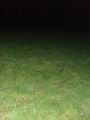
But again I had no tripod with me so I had to make several tries to get myself on a picture (some shots only show blades of grass, seeming white because of the camera flash). At last I had one and jogged back to the car, as usual.
All in all, a too easy hash.
Photos

Standard proof, 0.6 m this time!
On a meadow, again

As far as one can look

Me behind an illuminated blade of grass
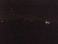
Looking west
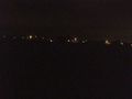
Looking north


