2018-03-15 47 -122
| Thu 15 Mar 2018 in Seattle: 47.8101643, -122.3612661 geohashing.info google osm bing/os kml crox |
Location
A return to Yost park, on a much easier to reach trail. Quite near a bus stop!
Participants
Plans
Stop by after work.
Expedition
I went to Yost park as part of a previous expedition, and returned the following weekend with my family. Will try to find those photos, in case of deja vu. If things are unchanged, this spot will be much easier to reach than the last time. Bus 116 is also nearby, Main St & Olympic Ave.
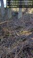
What I remember from my previous trip were large open sections with the creek nearby and one big swing. What I found near the geohash was an overgrown area of dried brambles, just waiting to come back to life, and a boggy area with some running water.
Probably this is because this location is towards the bottom of the big hill that is Yost park. Followed the trail (different from what is on openstreetmap and google - one day I should map that) and reached a point north of the point. 18 meters north, according to the GPS, though the power wires just east of here may be throwing that off.
I also determined there was no better way to approach, so off I stepped, into the dried brambles. Much less pokey that way! Soon I reached a boggy area with water ahead of me and one small felled tree. I moved along it's trunk and finally stopped, 8m short. I had gone further south than indicated in google maps. Could I reach GPS distance of zero by going further (and getting wetter)? Probably. Did another unknown trail lead to it from the other side? Unlikely. Was this good enough for today? Definitely.
Sparing my shoes, I returned to the trail and had a conversation about geohashing / geocaching. I then proceeded west and south to explore other avenues, fruitlessly. Posted pictures, but again, the power lines may interfere with the actual placement of them in the park.
Tracklog
Photos
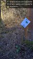
Trail edge @47.8103,-122.3612
From below @47.8102,-122.3612

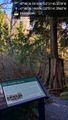
Geohasher @47.8102,-122.3612
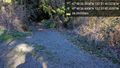
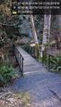
Trail junction @47.8102,-122.3617
West @47.8101,-122.3615
Bridges @47.8098,-122.3617


