2018-04-26 global
|
Globalhash on Thu 26 Apr 2018: |
Location
- This hashpoint is in the Bankhead National Forest in the Florence Alabama Graticule(34, -87)
Participants
NWoodruff
Coordinates Reached!
Wednesday April 25th, 2018 was like any other ordinary morning at work. At work, some of the first things that I do are check on statistics on webpages from the night before, look at web logs to verify traffic with Google, look for number of unique ip hits, look in error logs and so forth. I get to work by 7:30am so by 9am I am usually finished compiling reports and checking on error problems. Wednesday morning was no different. I start clicking on the Send/Recv button around 9:20 or so waiting for my daily email from my very own Notify Program. 9:25 am, no email, I was not expecting one as carabiner.peeron.com doesn't usually get the market open figures till 9:30. My program attempts to get the market open figures then but usually turns up empty handed. The program retries every 5 minutes.
On Cue at 9:39 the email appears. Now I have three places I have set. First is the location of my job and is set for 3 miles from my office for Monday through Friday(A function only available to me! That is the way it is when you write the program!). It is set for 3 miles because I usually ride a bicycle to work and three miles is as far as I would want to go out of my way home on my bicycle. Second is my house and is set for 20 miles. I have also set it not to overlap with the first location so it doesn't send me a second notification for the same spot(ALSO a function only available to ME!, sorry guys). And the last one is the Global location with no miles limit. But another function only available to me is that it only sends a notification if google is able to generate a .GPX file meaning that it is reachable. If google can't generate a .GPX file 99 out of 100 times, it usually isn't reachable because it is on another continent or in the ocean.
So most times I open up the XKCD notify email, there will be one reachable spot, if there is an email. So, Wednesday morning the notify program email pops up for me. I look at it and it is a notify for my home. That expedition can be found here 2018-04-25 Wednesday. I look at the attachments and notice that there are TWO attachments. That usually only happens on Friday for a location on Friday, Saturday and then Sunday. But today is Wednesday. Did the program not work correctly and sent me TWO .GPS files for the same location??? I look a little closer at the names and the second one says "GLOBAL". I take a second look to make sure it says "GLOBAL".
Yep, it says "GLOBAL". My heart skipped a beat. I looked at the link to see how close. I've been sent a .GPX file for a Global Hash in the farthest northern portions of Canada. Not reachable in one day. But I look at the distance... 174 miles(280km) What??? Am I reading that correctly?? I quickly clicked on the link to make sure it wasn't in the Atlantic Ocean. I was once sent a .GPX by google for a spot in the Atlantic that just happened to be on the British Cruse lines from New York to the UK. That trip wasn't going to happen. But I clicked on the provided link and it is in Alabama! I'm in business. Now is it reachable.
As I scroll in it is in the Bankhead National Forest. YEA! It is on public land and therefor reachable, unlike the last Global Hash in Kentucky that was on commercial land and iffy if it would have been reachable. I open the attached .GPX route that google generated and googled wanted me to drive up someone's driveway and walk through their property over a 200 foot tall mountain and two rivers to make it to the Global hash spot. I knew from past experiences that out in the middle of nowhere people don't like you walking their property to find a spot that the Dow Jones picked for them. I was beginning to think that I wouldn't attempt it. But I brought up the satellite map on google and started looking for alternate ways to make it to the spot.
There is a public road that goes north of the Geohash spot road 196 that appears to be a dirt road... Google Picture that leads to what looks like some kind of road that leads to High voltage Power lines and is probably used to access them. The good news is it runs along the ridge line and if nothing else I could walk the last mile and a half to two miles. AND the good news is it looked like I didn't have to cross any rivers or streams. So I made up my mind that I was going. I emailed a few people in the southern states letting them know that a global hash was within driving distance and if anyone of them wanted to show up in Atlanta tomorrow morning, they could ride along with me, much like Million-Zillion did for my last Global hash.
I then sent an email to everyone in the IT department(only 5 people) that I was taking a personal day tomorrow and would not be in. I then sent a note to my boss, that I had to take care of personal business in the morning and would not be in. It was less than an hour before I got a response from my boss that it was okay and if I needed anything that could help me just let her know. I thought about asking her if she wanted to go along, but thought better of it.
So, As much as I like to drive my own vehicles, I thought it would be better to rent("Hire" for you U.K. people) one than drive my own, much like I did for the last two Global hashes. I signed on to Enterprise Rent-A-Car and picked out the cheapest car I could get. I've always done that and they have always given me a better car because they never have the cheapest car available. But the total cost on the car was $22.42 for day. Gas there and back cost $33.50. Total cost was cheaper than a one way bus ticket to Huntsville Alabama. I also made it back to turn in the rental vehicle with only 15 minutes to spare or would have been charged with an addition half day rental fee. So I got lucky. So, the rental car was set and all I had to do was stop by Enterprise on my ride home from work. You can view my ride home from work and me stopping at the rental car place here.
So, I get home with the car and I start plotting out points different from what the .GPX file that google sent me to take me down the access road to the power lines. I use the program Easy GPS because it is free and does most the things that I need to do. I use it to remove the last few route points that google is sending me on to route points that I had picked out to take me to the dirt road that I picked out that google doesn't know about yet. I then use Easy GPS to send the turn by turn direction to my Garmin eTrex. The car that I rented has a good stereo system with Bluetooth connectivity. So I get my music player which is a RUIZU X06. It says that it takes upto a 64Gb card but I have a 128Gb card and have my 300+ CD collection on it in .FLAC. The car also has On-Star via Enterprise which means I'll have a mobile hot spot the entire time, so I take my laptop out to the car and connect it to the in-car WiFi just to make sure it works and pack up the laptop too, to take along just in case.
I usually get up in the morning for work at 5:45am so I bump the alarm ahead 1 hour to 6:45am. No need to get up really early to go find a Global hash spot although the excitement was there.
I wake up in the morning this morning to RAIN. Somewhat heavy rain. I had looked at the weather the night before so I was expecting some rain but not this much. I was beginning to wonder if I was going to be able to make a near 2 mile trek through the woods in this kind of rain. So, I shower, grab an extra set of clothes, shoes and socks, grab the electronics and head out to the car. I power up both the eTrex and the Garmin 705 bicycle GPS. The bicycle GPS has a map of all road in North America. It comes in handy at times when google tells you to make a turn but you can't figure out if it is an actual turn or just a continuation of a road that had a name change, as the eTrex only has the tracks and no roads on it. I grab a pop-tart and I have a travel mug full of iced-tea so I am now good to go.
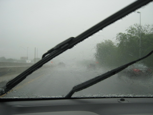
I get out on the road pointed in the correct direction and I am stuck in heavy Atlanta traffic because of the rain until I get west a few miles outside of Atlanta. As I cross the Georgia-Alabama state line, I loose the local Atlanta radio station I was listening to and also the light rain turns into a heavy down pour all the way to Birmingham Alabama some 50 miles away. I turn off the radio and turn on the RUIZU. The car sound system, I found out, will not let you pair a Bluetooth device to the audio system while the car is in motion. So, I sit in silence as I drive through the pouring rain until I get to a gas station a few miles east of Birmingham for a fill up and a bathroom break.
I get back into the car and pair the mp3 player that plays .FLAC and click through the device till I find Gloria Radio. Gloria Radio is a mix tape my younger brother made for his Girlfriend he had just after he got divorced in 1997. So it is mostly 1990's and late 1980's music. But he acts like a DJ for Gloria Radio so she would laugh at him every time she listened to it. they broke up in 2003 and when I went to visit my younger brother in 2005 in Florida, I came across the two cassettes with Gloria Radio written on them and made the mistake of asking. After an hour explanation that I wasn't really interested in, he started playing the tape. I though it was interesting and asked if I could borrow it and take it home to Georgia and make a copy of it and send it back in the mail when I was done with it. He said fine and now Gloria Radio lives on. Download your own copy if you like. I labeled them as CD's as I made a CD for my car out of each side of the cassette tape. I now only play it from Bluetooth and no longer have a CD player in the car.
Making through rush hour traffic in Birmingham as they are an hour behind Georgia on Central time instead of Eastern, I was again beginning to wonder if I was going to be able to trek two miles through the woods in this pouring rain that had persisted for 60 some odd miles all the way from the Georgia line. It seems that for some reason that I always seem to get lucky with Global Hashes. 30 miles north of Birmingham, the rain started to let up to a light drizzle all the way to the forest entrance. I once again thanked the Dow Jones for finding the right spot on the right day and having the right weather to be able to reach it.
As I get within 3 or 4 miles of the Global Hash spot, I turn off of the final tarmac and onto the dirt road. It has been a long time that I have driven down dirt roads, so it brought back old memories from the early 1980s when 10 miles outside of Atlanta was rural enough where I lived to have dirt roads. There was still about 2 miles to travel on this dirt road 196 before I would find the trail that I would have to get out and walk the rest of the way. It was slow going on this dirt road as it had been raining hard there too and much of this dirt road, although it had gravel on it, was laden with holes full of water. I find the spot to turn on the trail and to my surprise it was actually a single lane dirt road that probably hadn't been driven on in a year or so. But I cautiously turn on it and start driving down it.
I start thinking I wonder if I could actually drive all the way to the Global Hash spot. Wouldn't that be amazing. Global hashing in a National Forest and not having to get out of your car. Though the farther I drive on this road the deeper the ditches become and more washed out it becomes. I start to have this fear that I get the car stuck in a ditch or slide off the side of the mountain and it is years before someone finds me. I cross under the High Voltage power lines and the pathway starts looking really rough. I have driving about a mile now on this path and have driven though washed out water filled road that I was thanking my lucky stars that the car did not get stuck. If you download my actual tracks from my eTrex here and look at it with this GPX viewer and view the satellite map you can see how far down the path I actually got with the car before I found a spot that the car could not cross.
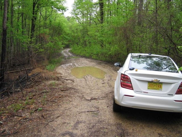
It didn't really matter because in 100 feet(30 meters) 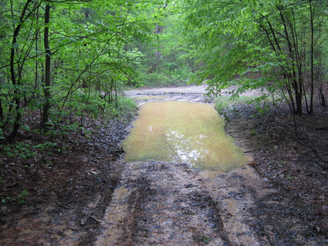
Or in another 100 feet...
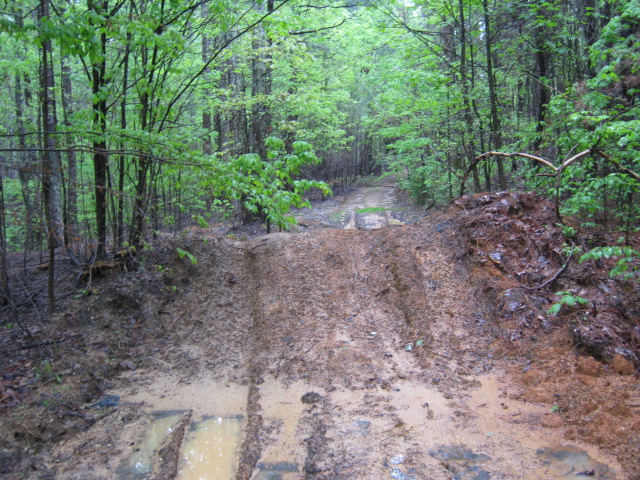
Or in 200 feet made it up this
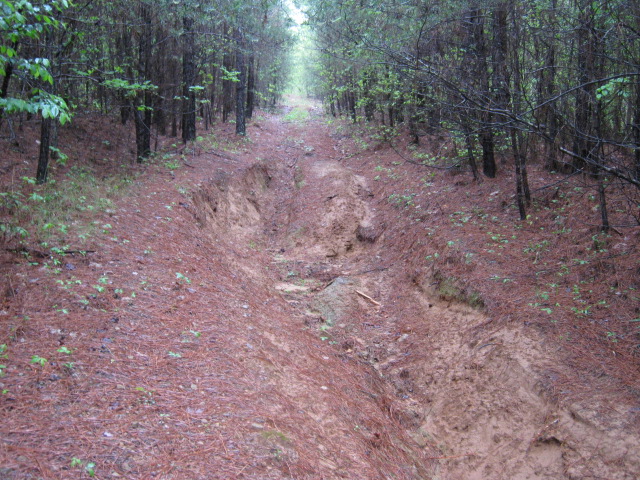
So driving any farther was kind of a moot point.
It was another 1000 feet(300 meters) that I found this
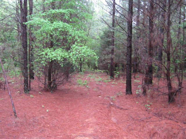
NWoodruff Gallery
Map links
NWoodruff earned the Globalhash achievement
|


