2018-11-12 47 -122
| Mon 12 Nov 2018 in Seattle: 47.7452559, -122.0280863 geohashing.info google osm bing/os kml crox |
Location
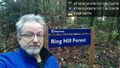
The northern edge of the Ring Hill Forest , between Woodinville and Duvall
Participants
Plans
Visit before work
Expedition
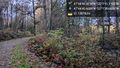
Ring Hill Forest is a working resource land, that is, it was originally logged and now portions will be logged regularly. This seems like a pretty smart plan, and the website contains a lot of excellent details on the subject.
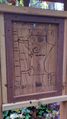
The "trail" leading into the wood is a logging road, though grown over with grass in many points. I walked down a bit and easily found a spot near the geohashpoint for today. Not quite as near, but on the same bearing, was a very elaborate treehouse (pictured below).
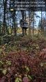
After requisite photographs (no marker this time), I continued down the road. Various trails peeled off for Tuck Creek and other attractions. I decided to follow the trail labeled "Snoqualmie Overlook", and this resulted in another picture or two below.
With great success on a brisk morning walk (single digit Celsius, upper 30s Fahrenheit) I returned generally uphill to my vehicle and thence onto work.
Tracklog
Photos
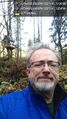
Geohasher @47.7450,-122.0296
Map
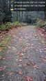
Logging road @47.7452,-122.0288
Geohash house @47.7452,-122.0282
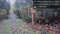
Hash point @47.7453,-122.0281
Towards the exit @47.7452,-122.0277
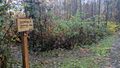
Signpost
Bridge @47.7406,-122.0215
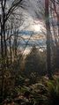
From the viewpoint


