2020-05-09 50 -3
| Sat 9 May 2020 in 50,-3: 50.8281465, -3.5649037 geohashing.info google osm bing/os kml crox |
Location
In a field near the A3072, between Stockleigh and Cadbury.
Participants
Expedition
Harowcal’s journey
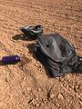
Departed around 16.20 and cycled north along St. Andrew's road, joining the A377 at Cowley. The early ride was uneventful except for finding some geotrash – what appeared to be a half-eaten sandwich someone had chucked out their car. Some people are disgusting.
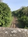
Crossed the railway when it came alongside the River Creedy and headed up Langford road into Mid Devon. This part of the journey seemed a very nice example of English countryside. Passed one house with a large estate that had, among other things, a peacock in the garden. Also saw some mysterious cobwebs in the roadside hedge.
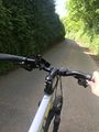
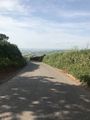
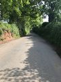
Followed the road through Langford, Shute, and Efford. Eventually reached Raddon hill, a truly arduous climb. Was forced to get off bike and push for most of the way. The summit opened onto an amazing view of the lands on the other side of the hill (I unfortunately didn't go far enough forward to capture it properly). Then turned along Scratchface Lane, where I met some friendly cows as well as a horse and rider. The path to the geohash was down a dirt road with an extreme slope, leading to a very bumpy ride. Almost hit my head on a low hanging branch but managed to break just in time.
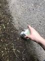
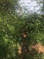
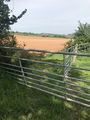
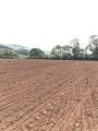
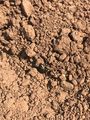
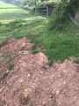
First attempted to enter the hashfield at the north end, near the geohash, by climbing over the dirt wall at a gap in the vegetation where it had clearly been scaled before, but was thwarted by the overgrown fence. Returning to a gate I had passed at the southern end of the field proved more successful. According to Google maps this field was supposed to be verdant green, but I found nothing but dust. Arrived at the geohash at 16.00, but was unfortunately the only attendee. Spotted a bird circling overhead, perhaps this was a relative of the elusive raptors, and found a beetle in the dust.
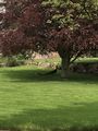
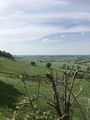
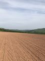
Left the marker outside the field where it was, marginally, more likely to be seen and climbed back onto paved road. Shortly after leaving the geohash I realised I forgot the stupid grin, so I dropped into a nearby field and took a photo (the hashfield is the small brown field that can be seen in the left).
Had a great deal of fun speeding down Raddon hill after spending so long climbing it. Remaining journey was uneventful, although I did help direct a member of a group of horse riders back to the group they had lost. The peacock was not sighted again. Crossed the railway and river and returned to Exeter at around 17.30. Will probably take less photos on future expeditions.
Photos
Geotrashing. This is someone's lunch??
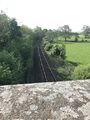
Railway line, looking north (towards the hash)
A common Devonshire peacock
Mysterious cobwebs
This hill is killing me
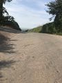
At last! The summit!
The other side, a strange and wondrous land
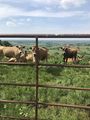
Friendly cows
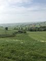
A beautiful view
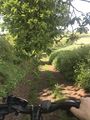
Photo taken moments before disaster
The first approach (failure)
The second approach (success)
The hashfield

Proof
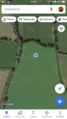
Google Maps the LIAR
4pm and no one else
A desolate land
Does this look green Google Maps?
Desert beatle
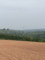
A bird, possible relation of raptors
Green again!
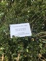
The marker
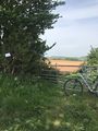
Marker, gate, & trusty steed
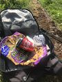
Collection of geotrash

Stupid grinTM
Where I took the photo
So much nicer downhill
Railway line, looking south (homeward)


Achievements
Harowcal earned the Land geohash achievement
|
Harowcal earned the Bicycle geohash achievement
|
Harowcal earned the GeoTrash Geohash Achievement
|