2020-09-07 51 13
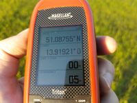
| Mon 7 Sep 2020 in Dresden: 51.0875496, 13.9192150 geohashing.info google osm bing/os kml crox |
Location
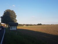
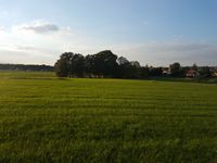
Today's location is in a Wiese (see below) at Radeberg-Großerkmannsdorf
Country: Germany; state: Sachsen (Saxony, EU:DE:SN); district: Bautzen; municipality: Radeberg
Expedition
Danatar
I might even have visited this hashpoint on any other day, as it is in doable distance for a cycling tour, but today there wasn't really any doubt. Because some years ago I did another bike trip about 80 km east of here, visiting my very first hashpoint. Yes, it's my twelfth hashiversary, that is a long time to keep true to a hobby.
After work I jumped on my bike and cycled along the Elbe to the Loschwitz bridge, on the other side of which the most dreaded part of the journey awaited me: Grundstraße. That's a street name, Grund street. It doesn't sound dangerous, does it? Your dictionary might translate Grund as "reason, cause, property, ground, base (the last only in words combinations)", which are totally different meanings. Well, to learn about the hidden knowledge that makes me shiver whenever I think about that street, we'll have to crawl deep into the many meanings of the German word Grund. While in another context it might mean "cause" or "reason", which is the meaning most often used in German (like in Kündigungsgrund or ein guter Grund, jemandem auf die Fresse zu hauen), here one of the older meanings is correct. Those are either "bottom" like in Meeresgrund = "the bottom of the sea" or it has, rather related actually, something to do with a low-lying area, often a valley, e.g. Talgrund (the deepest part of a valley) or Wiesengrund (a meadow in a valley, with Wiese=meadow). Okay, so now you know that Grundstraße has something to do with a valley, the valley of the Loschwitz creek in this case, we're getting nearer to the root of the problem. Because wherever you have a valley, you have a hill or mountain next to it. And, as you might remember, I was there with my bike. Indeed, I fear that street because is goes steeply uphill. 120 meter uphill within a length of 2.8 km, to be exact. I have used this street multiple times before for other expeditions, because there is no better way to reach the area east of Dresden by bike. Each time I was not happy having to cycle up that steep street with lots of traffic. There is only one other route to reach the eastern city districts from the city center so lots of people drive there. At least there is a small cycling lane along a part of the street, so the cars don't have to wait for too long before they can overtake. Today it went unexpectedly well, I made it to the top in 15 minutes. Still I was overtaken by countless cars and a few cyclists with electric bikes, and one guy on a normal bike (but with very muscular calves). I wrote a poem about my trauma with that street:
In tiefsten Tales Grunde ein Geohasher schwitzt,
auf hartem Fahrradsattel sein armer Hintern sitzt.
Der Punkt für heute ist nicht fern, doch wird's kein Kinderspiel,
man muss den Berg erklimmen, sonst kommt man nicht ans Ziel.
Die Autofahrer sind erbost, sie kommen nicht vorbei,
mit eig'ner Kraft geht nicht so schnell die Bergauf-Radelei.
Doch hat man dann geschafft den Berg, ist an der höchsten Stell',
dann freut man sich und denkt daran: Der Rückweg, der wird schnell!
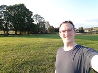
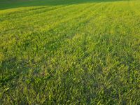
Having vanquished the most difficult part of the route, I then cycled to Bühlau where I turned left onto the smaller road towards Ullersdorf. That road leads along the edge of the Dresdner Heide forest and it has a gravel path next to it so I didn't have to cycle on the road for most of the route. The next part of the trip was uneventful, just along the forest. At Großerkmannsdorf I finally took a small field track before reaching the area near the hashpoint. I just had to walk across a large Wiese (yes, I've decided that you have to learn one German word in this report. Pronounciation would be like "Veesay" with the "y" silent for an English speaker) to reach the spot. There was grass, hooray... But the more important thing is that could finally sing "Happy geohashiversary to me". I didn't stay long, because the sun was nearing the horizon.
Back at my bike I continued on the same field track, which went a bit more uphill for a while before I had a nice view over the surrounding countryside. Then I cycled through Ullersdorf and from there back the same way as before. Grundstraße was lots of fun in this direction, it took me only 5 minutes to reach the lower end, I even had to brake a bit because another cyclist was in my way. Then I cycled through Striesen until I was home.
In the past year, my twelfth year of geohashing, I:
- visited another 11 hashpoints (out of 12 tries), one of that a globalhash
- met 6 new geohashers, awesome!
- cycled 65.8 km, walked 14.9 km, used public transport for 258 km and motorized vehicles for only 35.6 km
- spent another ~112 Euros while geohashing (almost all of that on the globalhash expedition)
Danatar earned the Twelfth Hashiversary achievement
|
|
