2021-06-27 40 -3
| Sun 27 Jun 2021 in 40,-3: 40.3096475, -3.9896821 geohashing.info google osm bing/os kml crox |
Location
In the regional park Monte Dehesa de Marimartín near Navalcarnero.
Participants
Plans
Expedition
This one was near the edge of the town Navalcarnero, about one kilometer from the next paved road as the crow flies. It looked like one could get pretty close to the geohash on unpaved roads with a little zigzagging.
This time I was going with a really heavy motorcycle which I call Wendy (referring to a certain song by Bruce Springsteen). She is much heavier than the old Goldwing, so unpaved roads are an absolute no-go. The plan was to park at the edge of town and make the rest by feet. The area seemed to be an unfinished new development area, with roads completed but houses not. So there should be ample parking space. To find a parking place for Wendy can be even more difficult than for a car. It needs almost a car's size, but should also be quite smooth and flat.
Everything went according to plan. It was a 40 minutes ride, mostly over roads which I already knew. They are among my favorites for motorcycle excursions, a bit hilly, gentle curves, little traffic. I could conveniently park the bike and then it was a 30 minutes walk. I followed the trails and did not try cross-country, which turned out to be a good idea. Otherwise, I would have ended up at a fence.
It was a nice walk. I took a couple of photos, my smartwatch reported the daily step target reached, and I did not see a single person.
Tracklog
Photos
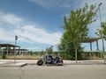
Convenient parking space for Wendy.
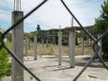
After the real estate bubble?
Now off the road into the wilderness.
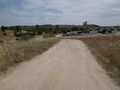
Look back to the edge of Navalcarnero.
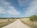
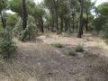
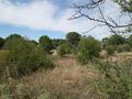
Wide open countryside.
It's indeed a dedicated trail.
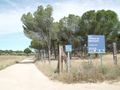
Fine, it's a recreation area, but the fence worried me. The geohash seemed to be on the other side.
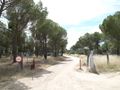
But behind this barrier, I am on the other side.
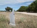
Just 15 meters from the trail.
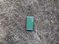
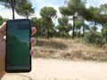
Here is the point.
At the bottom in the center, the mobile still marks the geohash.
On the way back...
... some views...
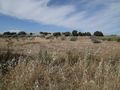
... of the landscape.


