2021-07-02 40 -4
| Fri 2 Jul 2021 in 40,-4: 40.3169726, -4.1277432 geohashing.info google osm bing/os kml crox |
Location
In the wilderness, near the road between Villamanta and Villamantilla.
Participants
Plans
Expedition
It was a hot day, 35° in the late afternoon, not unusal for central Spain in this season. The geohash was just a few tens of meters from a road near my home base, a barely fifteen minutes motorcycle ride away.
I could not park the motorcycle — at least not the heavy old Goldwing — by the side of the road most closely to the geohash. The nearest parking option was a few hundred meters away. So I had to walk quite a bit in the heat.
Walking alongside the road, I noticed a fence which had not been visible in Google Street View because the terrain was sloping down. Fortunately, the fence kinked away perpendicular from the road well before it approached the geohash.
When I finally had to leave the road, the vegetation turned out to be quite dense, with bushes, thorns and little trees. For some time, I could follow kind of a pathway, but it was soft and deep sand, like on the beach, on such a hot day quite laborious to walk. For the last 20 meters, I had really to push my way through bushes and thorns.
I reached the geohash after about 20 minutes of walking and took proof. The way back was now up sloping, and I was sweaty with heat and exertion when I reached the road. Still I had to walk a few hundred meters alongside the road.
So I was back at the bike after a total of 40 minutes walking through the heat (did I mention that it was a hot day?) and barely 15 minutes riding so far — I took the long way home.
Tracklog
Photos
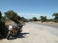
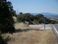
Parking space, some hundred meters away from the closest point to the geohash on the road.
The fence running parallel to the road ends!
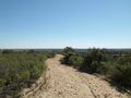
Now off the road, soft and deep sand, quite laborious path.
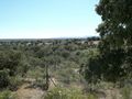
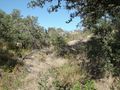
Finally on into the real wilderness.
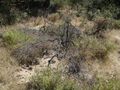
Witnesses of bush fires some time ago.
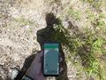
Proof — and kind of (multi-layered) selfie.
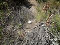
The bright stone marks the geohash.
Same stone in the center of the image, wider context.
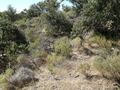
Way back, uphill.
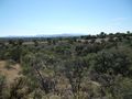
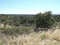
Last view over the landscape, Sierra Oeste in the background.
Back at the bike after 40 minutes walking.
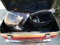
Put away the camera, take the helmet — and the long way home.


